

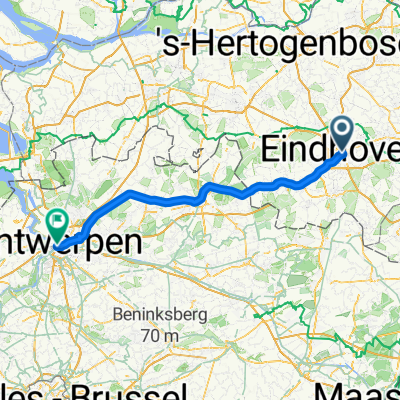
2. Tag Eindhoven-Aalst-Mierlo-Eindhoven
A cycling route starting in Eindhoven, North Brabant, The Netherlands.
Overview
About this route
- Tag
Noch in Bearbeitung
- -:--
- Duration
- 57.9 km
- Distance
- 110 m
- Ascent
- 112 m
- Descent
- ---
- Avg. speed
- 33 m
- Max. altitude

Route quality
Waytypes & surfaces along the route
Waytypes
Cycleway
29 km
(50 %)
Quiet road
15.6 km
(27 %)
Surfaces
Paved
28.4 km
(49 %)
Unpaved
15.6 km
(27 %)
Asphalt
24.3 km
(42 %)
Sand
8.1 km
(14 %)
Route highlights
Points of interest along the route
Point of interest after 0 km
Crown-Hotel Eindhoven
Point of interest after 8.2 km
p + R Meerhoven
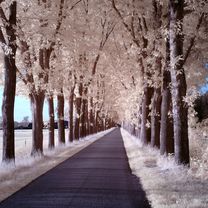
Photo after 8.6 km
hängender Fahrrad-Kreisel
Point of interest after 15.8 km
Aalst
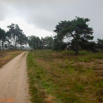
Point of interest after 28.3 km
Heeze
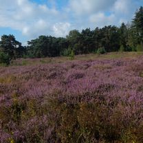
Point of interest after 35.1 km
Point of interest after 43.4 km
Mierlo
Point of interest after 47.4 km
Continue with Bikemap
Use, edit, or download this cycling route
You would like to ride 2. Tag Eindhoven-Aalst-Mierlo-Eindhoven or customize it for your own trip? Here is what you can do with this Bikemap route:
Free features
- Save this route as favorite or in collections
- Copy & plan your own version of this route
- Sync your route with Garmin or Wahoo
Premium features
Free trial for 3 days, or one-time payment. More about Bikemap Premium.
- Navigate this route on iOS & Android
- Export a GPX / KML file of this route
- Create your custom printout (try it for free)
- Download this route for offline navigation
Discover more Premium features.
Get Bikemap PremiumFrom our community
Other popular routes starting in Eindhoven
 Ochtendrit Rondje Strabrechtse heide
- Distance
- 38.6 km
- Ascent
- 33 m
- Descent
- 34 m
- Location
- Eindhoven, North Brabant, The Netherlands
 Rondje Bergeijk 42 km
- Distance
- 42.4 km
- Ascent
- 36 m
- Descent
- 37 m
- Location
- Eindhoven, North Brabant, The Netherlands
 Markt までGroenplaats
- Distance
- 90.8 km
- Ascent
- 84 m
- Descent
- 93 m
- Location
- Eindhoven, North Brabant, The Netherlands
 Ochtendrit op gravelbike
- Distance
- 41.9 km
- Ascent
- 77 m
- Descent
- 77 m
- Location
- Eindhoven, North Brabant, The Netherlands
 Avondrit op pad met de camera part 2
- Distance
- 27 km
- Ascent
- 30 m
- Descent
- 28 m
- Location
- Eindhoven, North Brabant, The Netherlands
 2. Tag Eindhoven-Aalst-Mierlo-Eindhoven
- Distance
- 57.9 km
- Ascent
- 110 m
- Descent
- 112 m
- Location
- Eindhoven, North Brabant, The Netherlands
 Ochtendrit andere route naar Strabrechtse heide
- Distance
- 43.7 km
- Ascent
- 84 m
- Descent
- 82 m
- Location
- Eindhoven, North Brabant, The Netherlands
 Door de Malpi &; Leenderbos
- Distance
- 51 km
- Ascent
- 97 m
- Descent
- 94 m
- Location
- Eindhoven, North Brabant, The Netherlands
Open it in the app