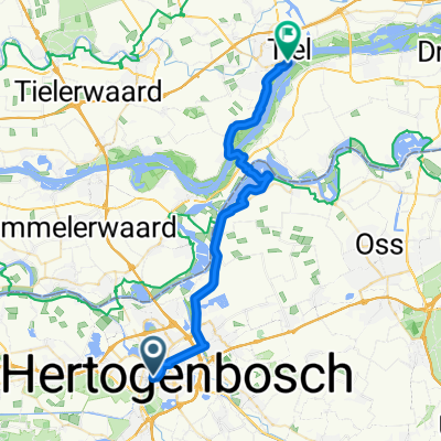
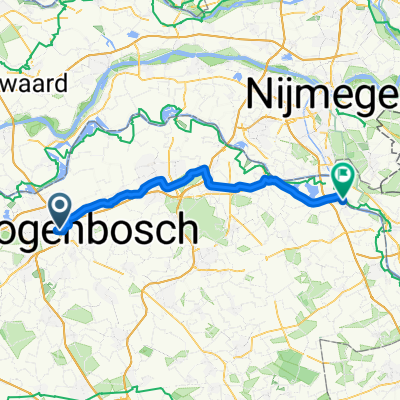
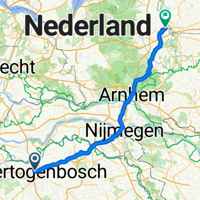
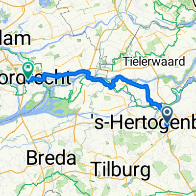
5. Tag S-Hertogenbosch-Eindhoven
A cycling route starting in 's-Hertogenbosch, North Brabant, The Netherlands.
Overview
About this route
 noch in Bearbeitung
Â
- -:--
- Duration
- 64.2 km
- Distance
- 155 m
- Ascent
- 137 m
- Descent
- ---
- Avg. speed
- 27 m
- Max. altitude
Route quality
Waytypes & surfaces along the route
Waytypes
Cycleway
28.7 km
(45 %)
Quiet road
20 km
(31 %)
Surfaces
Paved
39.9 km
(62 %)
Unpaved
8.6 km
(13 %)
Asphalt
30.2 km
(47 %)
Paving stones
8.7 km
(13 %)
Route highlights
Points of interest along the route
Point of interest after 7.4 km
Point of interest after 10.6 km
Nationaal Monument Kamp Vught
Point of interest after 12.1 km
Vughtse Heide
Point of interest after 27.7 km
Kampania
Point of interest after 45.6 km
Oirschotse Heide
Photo after 57.9 km
Hovenring
Point of interest after 63.9 km
Continue with Bikemap
Use, edit, or download this cycling route
You would like to ride 5. Tag S-Hertogenbosch-Eindhoven or customize it for your own trip? Here is what you can do with this Bikemap route:
Free features
- Save this route as favorite or in collections
- Copy & plan your own version of this route
- Sync your route with Garmin or Wahoo
Premium features
Free trial for 3 days, or one-time payment. More about Bikemap Premium.
- Navigate this route on iOS & Android
- Export a GPX / KML file of this route
- Create your custom printout (try it for free)
- Download this route for offline navigation
Discover more Premium features.
Get Bikemap PremiumFrom our community
Other popular routes starting in 's-Hertogenbosch
- Rosmalen - Grave -Ravenstein - Rosmalen
- Distance
- 81.5 km
- Ascent
- 28 m
- Descent
- 26 m
- Location
- 's-Hertogenbosch, North Brabant, The Netherlands
- 5. Tag S-Hertogenbosch-Eindhoven
- Distance
- 64.2 km
- Ascent
- 155 m
- Descent
- 137 m
- Location
- 's-Hertogenbosch, North Brabant, The Netherlands
- 20100512 Berlicum short
- Distance
- 31.1 km
- Ascent
- 15 m
- Descent
- 15 m
- Location
- 's-Hertogenbosch, North Brabant, The Netherlands
- DenBosch_Giersbergen
- Distance
- 31.2 km
- Ascent
- 57 m
- Descent
- 57 m
- Location
- 's-Hertogenbosch, North Brabant, The Netherlands
- Rondje Sint Michielsgestel Schijndel Heeswijk Berlicum Rosmalen
- Distance
- 41.3 km
- Ascent
- 26 m
- Descent
- 27 m
- Location
- 's-Hertogenbosch, North Brabant, The Netherlands
- De ronde van Zaltbommel
- Distance
- 52.9 km
- Ascent
- 30 m
- Descent
- 28 m
- Location
- 's-Hertogenbosch, North Brabant, The Netherlands
- Den Bosch Geffen Kaathoven
- Distance
- 32.6 km
- Ascent
- 12 m
- Descent
- 14 m
- Location
- 's-Hertogenbosch, North Brabant, The Netherlands
- Lengthy ride through 's-Hertogenbosch
- Distance
- 38.8 km
- Ascent
- 31 m
- Descent
- 32 m
- Location
- 's-Hertogenbosch, North Brabant, The Netherlands
Open it in the app