
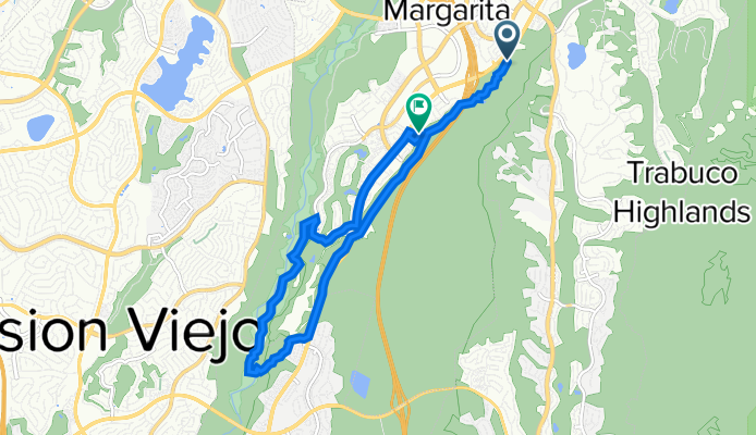
Antonio Pkwy, Rancho Santa Margarita to 9 Serene Canyon Rd, Rancho Santa Margarita
A cycling route starting in Rancho Santa Margarita, California, United States.
Overview
About this route
- 55 min
- Duration
- 12 km
- Distance
- 183 m
- Ascent
- 215 m
- Descent
- 13.1 km/h
- Avg. speed
- 294 m
- Max. altitude

Route quality
Waytypes & surfaces along the route
Waytypes
Path
5.3 km
(44 %)
Track
3.4 km
(28 %)
Surfaces
Paved
3.1 km
(26 %)
Unpaved
8.8 km
(73 %)
Ground
8.6 km
(71 %)
Asphalt
2.9 km
(24 %)
Continue with Bikemap
Use, edit, or download this cycling route
You would like to ride Antonio Pkwy, Rancho Santa Margarita to 9 Serene Canyon Rd, Rancho Santa Margarita or customize it for your own trip? Here is what you can do with this Bikemap route:
Free features
- Save this route as favorite or in collections
- Copy & plan your own version of this route
- Sync your route with Garmin or Wahoo
Premium features
Free trial for 3 days, or one-time payment. More about Bikemap Premium.
- Navigate this route on iOS & Android
- Export a GPX / KML file of this route
- Create your custom printout (try it for free)
- Download this route for offline navigation
Discover more Premium features.
Get Bikemap PremiumFrom our community
Other popular routes starting in Rancho Santa Margarita
 9 Serene Canyon Rd, Rancho Santa Margarita to 21 Evening Canyon Rd, Rancho Santa Margarita
- Distance
- 0.2 km
- Ascent
- 0 m
- Descent
- 0 m
- Location
- Rancho Santa Margarita, California, United States
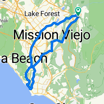 go the the beach
- Distance
- 65.9 km
- Ascent
- 1,045 m
- Descent
- 1,079 m
- Location
- Rancho Santa Margarita, California, United States
 9 Serene Canyon Rd, Rancho Santa Margarita to 24352–24398 Antonio Pkwy, Rancho Santa Margarita
- Distance
- 6.8 km
- Ascent
- 100 m
- Descent
- 148 m
- Location
- Rancho Santa Margarita, California, United States
 Mission Viejo LA Olympic Races 1984
- Distance
- 16.2 km
- Ascent
- 275 m
- Descent
- 276 m
- Location
- Rancho Santa Margarita, California, United States
 5 Serene Canyon Rd, Rancho Santa Margarita to 9 Serene Canyon Rd, Rancho Santa Margarita
- Distance
- 14.3 km
- Ascent
- 229 m
- Descent
- 228 m
- Location
- Rancho Santa Margarita, California, United States
 12 Calle del Luna, Rancho Santa Margarita to 22 Calle del Luna, Rancho Santa Margarita
- Distance
- 11.8 km
- Ascent
- 114 m
- Descent
- 107 m
- Location
- Rancho Santa Margarita, California, United States
 1–99 Serene Canyon Rd, Rancho Santa Margarita to 9 Serene Canyon Rd, Rancho Santa Margarita
- Distance
- 14.6 km
- Ascent
- 223 m
- Descent
- 227 m
- Location
- Rancho Santa Margarita, California, United States
 24 Calle del Mar, Rancho Santa Margarita to 20 Calle del Luna, Rancho Santa Margarita
- Distance
- 9.5 km
- Ascent
- 80 m
- Descent
- 78 m
- Location
- Rancho Santa Margarita, California, United States
Open it in the app