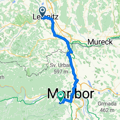
Percorso ciclabile della regione vinicola della Stiria - Percorso ciclabile della regione vinicola della Stiria
A cycling route starting in Leibnitz, Styria, Styria, Austria.
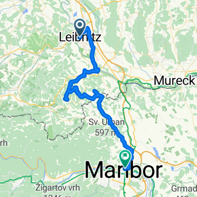
Overview
About this route
Su questo tour ad anello, la cui lunghezza è di circa 400 km, in otto tappe si va alla scoperta della regione vinicola della Stiria con le sue tre are vinicole e le loro specialità culinarie, nonché i tesori culturali.
- -:--
- Duration
- 402.4 km
- Distance
- 3,651 m
- Ascent
- 3,651 m
- Descent
- ---
- Avg. speed
- 679 m
- Avg. speed
Route quality
Waytypes & surfaces along the route
Waytypes
Quiet road
229.6 km
(57 %)
Busy road
46.6 km
(12 %)
Surfaces
Paved
233 km
(58 %)
Unpaved
37.9 km
(9 %)
Asphalt
226.3 km
(56 %)
Gravel
23.3 km
(6 %)
Continue with Bikemap
Use, edit, or download this cycling route
You would like to ride Percorso ciclabile della regione vinicola della Stiria - Percorso ciclabile della regione vinicola della Stiria or customize it for your own trip? Here is what you can do with this Bikemap route:
Free features
- Save this route as favorite or in collections
- Copy & plan your own version of this route
- Sync your route with Garmin or Wahoo
Premium features
Free trial for 3 days, or one-time payment. More about Bikemap Premium.
- Navigate this route on iOS & Android
- Export a GPX / KML file of this route
- Create your custom printout (try it for free)
- Download this route for offline navigation
Discover more Premium features.
Get Bikemap PremiumFrom our community
Other popular routes starting in Leibnitz
- Etappe 07 Murradweg Leibnitz - Bad Radkersburg - Etappe 07 Murradweg Leibnitz - Bad Radkersburg
- Distance
- 51.5 km
- Ascent
- 140 m
- Descent
- 200 m
- Location
- Leibnitz, Styria, Styria, Austria
- Stiefingtalrunde 2
- Distance
- 47.2 km
- Ascent
- 350 m
- Descent
- 353 m
- Location
- Leibnitz, Styria, Styria, Austria
- Percorso ciclabile della regione vinicola della Stiria - Percorso ciclabile della regione vinicola della Stiria
- Distance
- 402.4 km
- Ascent
- 3,651 m
- Descent
- 3,651 m
- Location
- Leibnitz, Styria, Styria, Austria
- 1. Tag, 17.05.25: Leibniz-Deutschlandsberg-Stainz
- Distance
- 49.8 km
- Ascent
- 556 m
- Descent
- 481 m
- Location
- Leibnitz, Styria, Styria, Austria
- Leibnitz Kranach Gamlitz Grubtal
- Distance
- 49.5 km
- Ascent
- 640 m
- Descent
- 642 m
- Location
- Leibnitz, Styria, Styria, Austria
- Leibnitz -Ehrenhausen MTB- Herbstrunde 15
- Distance
- 39.8 km
- Ascent
- 569 m
- Descent
- 585 m
- Location
- Leibnitz, Styria, Styria, Austria
- Großkleinrunde 2
- Distance
- 45.1 km
- Ascent
- 524 m
- Descent
- 525 m
- Location
- Leibnitz, Styria, Styria, Austria
- Unbenannte Route
- Distance
- 21.3 km
- Ascent
- 580 m
- Descent
- 503 m
- Location
- Leibnitz, Styria, Styria, Austria
Open it in the app