

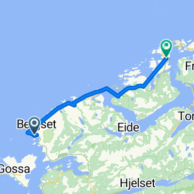
Elnesvågen - Farstad - Bud
A cycling route starting in Elnesvågen, Møre og Romsdal, Norway.
Overview
About this route
Godt tur på vanlig asphaltvei med lite traffik. Vei fra Bud tilbake til Elnesvågen har sykkelvei på stor deler. Hvis du har bil med er det muligh å starte på Bølgensenter i Elnesvågen sentrum.
- -:--
- Duration
- 54.2 km
- Distance
- 269 m
- Ascent
- 269 m
- Descent
- ---
- Avg. speed
- ---
- Max. altitude
Route quality
Waytypes & surfaces along the route
Waytypes
Cycleway
13.5 km
(25 %)
Quiet road
0.5 km
(1 %)
Surfaces
Paved
41.7 km
(77 %)
Asphalt
41.7 km
(77 %)
Undefined
12.5 km
(23 %)
Continue with Bikemap
Use, edit, or download this cycling route
You would like to ride Elnesvågen - Farstad - Bud or customize it for your own trip? Here is what you can do with this Bikemap route:
Free features
- Save this route as favorite or in collections
- Copy & plan your own version of this route
- Sync your route with Garmin or Wahoo
Premium features
Free trial for 3 days, or one-time payment. More about Bikemap Premium.
- Navigate this route on iOS & Android
- Export a GPX / KML file of this route
- Create your custom printout (try it for free)
- Download this route for offline navigation
Discover more Premium features.
Get Bikemap PremiumFrom our community
Other popular routes starting in Elnesvågen
 4 Hustadvika – Hollingsholm - Småge
- Distance
- 79.3 km
- Ascent
- 298 m
- Descent
- 297 m
- Location
- Elnesvågen, Møre og Romsdal, Norway
 Elnesvågen - Farstad - Bud
- Distance
- 54.2 km
- Ascent
- 269 m
- Descent
- 269 m
- Location
- Elnesvågen, Møre og Romsdal, Norway
 to the tunnel
- Distance
- 75.5 km
- Ascent
- 792 m
- Descent
- 778 m
- Location
- Elnesvågen, Møre og Romsdal, Norway
 6 - Tornes Hollingen
- Distance
- 36.4 km
- Ascent
- 211 m
- Descent
- 214 m
- Location
- Elnesvågen, Møre og Romsdal, Norway
 EuroVelo 1 - Part 10 - From Hustad to Fiskåbygd
- Distance
- 248.9 km
- Ascent
- 755 m
- Descent
- 748 m
- Location
- Elnesvågen, Møre og Romsdal, Norway
 EuroVelo 1 - Part 26
- Distance
- 108.7 km
- Ascent
- 949 m
- Descent
- 952 m
- Location
- Elnesvågen, Møre og Romsdal, Norway
 les avions à vélo: Day 29 manque 1/2!
- Distance
- 51.5 km
- Ascent
- 418 m
- Descent
- 413 m
- Location
- Elnesvågen, Møre og Romsdal, Norway
 2011 NOR - Atlanterhavsvegen
- Distance
- 53.4 km
- Ascent
- 260 m
- Descent
- 260 m
- Location
- Elnesvågen, Møre og Romsdal, Norway
Open it in the app