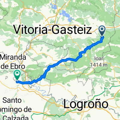
Agurain / Salvatierra - Elexalde
- 70.6 km
- 910 m
- 1,460 m
- Agurain / Salvatierra, Basque Country, Spain
Route through the Alava plain, on both sides of the highway. Small secondary roads in the middle of the route connecting small villages and a bit busier when crossing the highway to the north.
You can visit very interesting churches like the one in Gazeo, with prior notice.
Road
37.4 km46 %Track
16.3 km20 %Paved
3.3 km(4 %)Unpaved
17.9 km(22 %)Ground
8.1 km10 %Unpaved (undefined)
4.9 km6 %Free trial for 3 days, or one-time payment. More about Bikemap Premium.
Discover more Premium features.
Get Bikemap PremiumOpen it in the app