

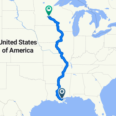
Morning Route to Work
A cycling route starting in Kenner, Louisiana, United States.
Overview
About this route
Transcontinental Route is okay in the morning, Wabash is pretty sleepy in the morning. L&A Road has been a revelation! Smooth sailing into the city unless there's a train passing. The only hill that you'll have to be concerned about is the Palmetto Street overpass, be careful with a slight crack in the pavement when you make your decline. There's a rarely used on-ramp to the overpass, but do a quick look behind to the right before you ascend. Thalia Street is AWFUL! Slow down for lake-sized potholes. Felicity is under heavy construction as well, so you might want to consider taking Jackson Ave.
- -:--
- Duration
- 17.5 km
- Distance
- 16 m
- Ascent
- 14 m
- Descent
- ---
- Avg. speed
- 7 m
- Max. altitude
Route quality
Waytypes & surfaces along the route
Waytypes
Quiet road
7.8 km
(45 %)
Road
6.1 km
(35 %)
Surfaces
Paved
13.1 km
(75 %)
Asphalt
13 km
(74 %)
Concrete
0.1 km
(<1 %)
Undefined
4.4 km
(25 %)
Continue with Bikemap
Use, edit, or download this cycling route
You would like to ride Morning Route to Work or customize it for your own trip? Here is what you can do with this Bikemap route:
Free features
- Save this route as favorite or in collections
- Copy & plan your own version of this route
- Sync your route with Garmin or Wahoo
Premium features
Free trial for 3 days, or one-time payment. More about Bikemap Premium.
- Navigate this route on iOS & Android
- Export a GPX / KML file of this route
- Create your custom printout (try it for free)
- Download this route for offline navigation
Discover more Premium features.
Get Bikemap PremiumFrom our community
Other popular routes starting in Kenner
 Kenner to West End or So
- Distance
- 13.5 km
- Ascent
- 0 m
- Descent
- 0 m
- Location
- Kenner, Louisiana, United States
 GREAT MISSISSIPPI RIVER RIDE
- Distance
- 2,605.5 km
- Ascent
- 865 m
- Descent
- 600 m
- Location
- Kenner, Louisiana, United States
 River Levee To Spillway
- Distance
- 22.9 km
- Ascent
- 53 m
- Descent
- 52 m
- Location
- Kenner, Louisiana, United States
 1501 Disney to Audubon Zoo via Mississippi River Levee Trail
- Distance
- 23.4 km
- Ascent
- 52 m
- Descent
- 49 m
- Location
- Kenner, Louisiana, United States
 New Orleans
- Distance
- 79.7 km
- Ascent
- 25 m
- Descent
- 24 m
- Location
- Kenner, Louisiana, United States
 Metairie Levee - Bucktown
- Distance
- 20.9 km
- Ascent
- 49 m
- Descent
- 53 m
- Location
- Kenner, Louisiana, United States
 4300–4318 Elmwood Pkwy, Metairie to 6600 Wilty St, Metairie
- Distance
- 8.4 km
- Ascent
- 24 m
- Descent
- 26 m
- Location
- Kenner, Louisiana, United States
 6604 Wilty St, Metairie to 6604 Wilty St, Metairie
- Distance
- 7.3 km
- Ascent
- 33 m
- Descent
- 29 m
- Location
- Kenner, Louisiana, United States
Open it in the app