
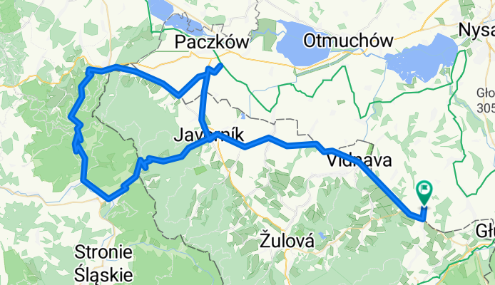
Sławniowice - Sławniowice (przez Javornik, Lądek Zdrój, Złoty Stok)
A cycling route starting in Głuchołazy, Opole Voivodeship, Poland.
Overview
About this route
Sławniowice - Velke Kunietice - Vidnava - Javornik - Travna - Przełęcz Lądecka - Lądek Zdrój - Złoty Stok - Bila Voda - Gościce - Unikowice - Bily Potok - Javornik - Vidnava - Velke Kunietice - Sławniowice
The route is half flat and half hilly. There are two major climbs: to Lądecka Pass and on the road from Lądek Zdrój to Złoty Stok. The short climbs on the segment from Vidnava to Velke Kunietice are also tiring. Other than that, it's quite easy and flat.
It's worth stopping in Javornik, for the Castle on Janowe Hill and to admire the views from Lądecka Pass. On the segment from Javornik to Travna, there is a very nice, renovated lime kiln with a description of the history of lime burning in the area.
- -:--
- Duration
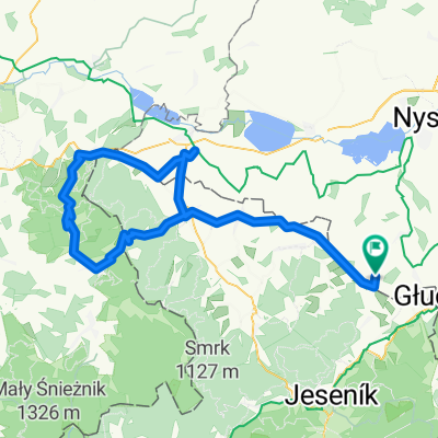
- 99.9 km
- Distance
- 930 m
- Ascent
- 930 m
- Descent
- ---
- Avg. speed
- ---
- Max. altitude

Route quality
Waytypes & surfaces along the route
Waytypes
Road
10 km
(10 %)
Quiet road
4 km
(4 %)
Surfaces
Paved
87.9 km
(88 %)
Unpaved
4 km
(4 %)
Asphalt
87.9 km
(88 %)
Ground
3 km
(3 %)
Continue with Bikemap
Use, edit, or download this cycling route
You would like to ride Sławniowice - Sławniowice (przez Javornik, Lądek Zdrój, Złoty Stok) or customize it for your own trip? Here is what you can do with this Bikemap route:
Free features
- Save this route as favorite or in collections
- Copy & plan your own version of this route
- Split it into stages to create a multi-day tour
- Sync your route with Garmin or Wahoo
Premium features
Free trial for 3 days, or one-time payment. More about Bikemap Premium.
- Navigate this route on iOS & Android
- Export a GPX / KML file of this route
- Create your custom printout (try it for free)
- Download this route for offline navigation
Discover more Premium features.
Get Bikemap PremiumFrom our community
Other popular routes starting in Głuchołazy
 Pradziad ***
- Distance
- 111.5 km
- Ascent
- 1,831 m
- Descent
- 1,830 m
- Location
- Głuchołazy, Opole Voivodeship, Poland
 dookoła Biskupiej Kopy - krotka
- Distance
- 27 km
- Ascent
- 458 m
- Descent
- 457 m
- Location
- Głuchołazy, Opole Voivodeship, Poland
 2007-05-26 Glucholazy Kopa Biskupia Głuchołazy
- Distance
- 36.2 km
- Ascent
- 784 m
- Descent
- 786 m
- Location
- Głuchołazy, Opole Voivodeship, Poland
 chorwacja wegry off
- Distance
- 1,154.1 km
- Ascent
- 1,999 m
- Descent
- 2,278 m
- Location
- Głuchołazy, Opole Voivodeship, Poland
 Sławniowice - Sławniowice (przez Javornik, Lądek Zdrój, Złoty Stok)
- Distance
- 99.9 km
- Ascent
- 930 m
- Descent
- 930 m
- Location
- Głuchołazy, Opole Voivodeship, Poland
 Obóz w Głuchołazach: Wycieczka na Pradziada
- Distance
- 113 km
- Ascent
- 2,309 m
- Descent
- 2,025 m
- Location
- Głuchołazy, Opole Voivodeship, Poland
 Sławniowice - Sławniowice (przez Jesenik, Vidly, Karlovą Studankę, Vrbno, Zlate Hory, Mikulovice)
- Distance
- 85.6 km
- Ascent
- 1,236 m
- Descent
- 1,241 m
- Location
- Głuchołazy, Opole Voivodeship, Poland
 Trasa rodzinna - Gold Hill MTB Maraton Głuchołazy 2016
- Distance
- 13.2 km
- Ascent
- 417 m
- Descent
- 410 m
- Location
- Głuchołazy, Opole Voivodeship, Poland
Open it in the app