


Etappe 2 Gardasee
- 89.9 km
- 2,225 m
- 1,852 m
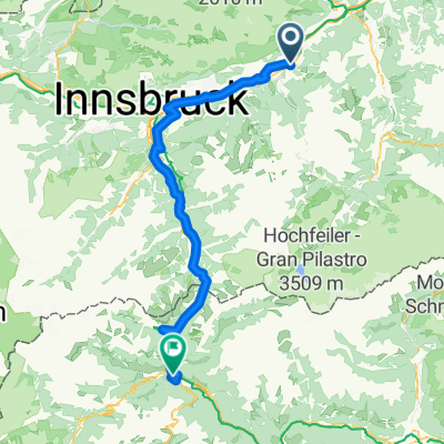
- Pill, Tyrol, Austria
A cycling route starting in Pill, Tyrol, Austria.
Overview
Pill - Loassattel 1675m - Hochfügen - Finsing - Mayrhofen / Stage 1 Basic: only to Finsing, from there by train / bus to Mayrhofen / --> minus 20 km, minus 100 m elevation gain
created this 3 years ago
Route quality
Track
29.5 km
(54 %)
Quiet road
11.5 km
(21 %)
Paved
25.7 km
(47 %)
Unpaved
22.4 km
(41 %)
Asphalt
24.6 km
(45 %)
Gravel
22.4 km
(41 %)
Continue with Bikemap
You would like to ride Biketour22 Etappe1 Loassattel Plus or customize it for your own trip? Here is what you can do with this Bikemap route:
Free trial for 3 days, or one-time payment. More about Bikemap Premium.
Discover more Premium features.
Get Bikemap PremiumFrom our community
Open it in the app


