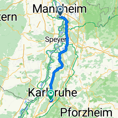
Von Mannheim bis Karlsruhe
- 71.5 km
- 162 m
- 138 m
- Altrip, Rhineland-Palatinate, Germany
A cycling route starting in Altrip, Rhineland-Palatinate, Germany.
Overview
By mountain bike from the Rhine to the Southwest Palatinate at the border with the Northern Vosges.
created this 14 years ago
Route highlights
Forsthaus Heldenstein Rast, Essen + Trinken
Forsthaus Taubensuhl Rast, Essen + Trinken
Paddelweiher Rast, Essen + Trinken
Pfälzerwaldhütte Dicke Eiche Rast, Essen + Trinken
Bärenbrunnerhof, Rasten, Essen + Trinken
Schöntal Weiher Baden, Essen und Trinken
Pfälzerwaldhütte Hohe List Übernachtungsmöglichkeit am Wochenende
Continue with Bikemap
You would like to ride Altrip - Hohe List or customize it for your own trip? Here is what you can do with this Bikemap route:
Free trial for 3 days, or one-time payment. More about Bikemap Premium.
Discover more Premium features.
Get Bikemap PremiumFrom our community
Open it in the app