

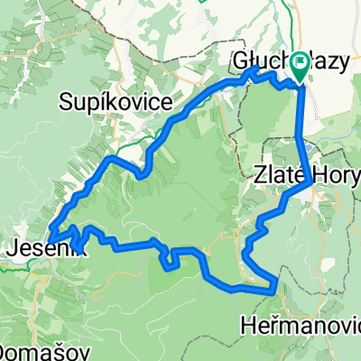
Sławniowice - Sławniowice (przez Jesenik, Czervenohorske Sedlo, Louczną nad Desną, Dlouhe Stranie, Kouty nad Desnou, Czervenohorske Sedlo, Jesenik)
A cycling route starting in Głuchołazy, Opole Voivodeship, Poland.
Overview
About this route
Sławniowice - Jesenik - Louczna nad Desnou, Dlouhe Stranie - Kouty nad Desnou - Czervenohorske Sedlo - Jesenik - Supikovice - Slawniowice.
Royal route.
- -:--
- Duration
- 112.4 km
- Distance
- 1,990 m
- Ascent
- 1,990 m
- Descent
- ---
- Avg. speed
- ---
- Max. altitude

Route quality
Waytypes & surfaces along the route
Waytypes
Quiet road
18 km
(16 %)
Track
10.1 km
(9 %)
Surfaces
Paved
68.5 km
(61 %)
Unpaved
9 km
(8 %)
Asphalt
68.5 km
(61 %)
Gravel
5.6 km
(5 %)
Continue with Bikemap
Use, edit, or download this cycling route
You would like to ride Sławniowice - Sławniowice (przez Jesenik, Czervenohorske Sedlo, Louczną nad Desną, Dlouhe Stranie, Kouty nad Desnou, Czervenohorske Sedlo, Jesenik) or customize it for your own trip? Here is what you can do with this Bikemap route:
Free features
- Save this route as favorite or in collections
- Copy & plan your own version of this route
- Split it into stages to create a multi-day tour
- Sync your route with Garmin or Wahoo
Premium features
Free trial for 3 days, or one-time payment. More about Bikemap Premium.
- Navigate this route on iOS & Android
- Export a GPX / KML file of this route
- Create your custom printout (try it for free)
- Download this route for offline navigation
Discover more Premium features.
Get Bikemap PremiumFrom our community
Other popular routes starting in Głuchołazy
 Głuchołazy - Jesenik - Głuchołazy 12_11_11
- Distance
- 56.3 km
- Ascent
- 1,149 m
- Descent
- 1,149 m
- Location
- Głuchołazy, Opole Voivodeship, Poland
 Rozprostować skrzydła
- Distance
- 26.3 km
- Ascent
- 117 m
- Descent
- 116 m
- Location
- Głuchołazy, Opole Voivodeship, Poland
 Sławniowice - Sławniowice (przez Jesenik, Czervenohorske Sedlo, Louczną nad Desną, Dlouhe Stranie, Kouty nad Desnou, Czervenohorske Sedlo, Jesenik)
- Distance
- 112.4 km
- Ascent
- 1,990 m
- Descent
- 1,990 m
- Location
- Głuchołazy, Opole Voivodeship, Poland
 MTB Gold Hill Glucholazy
- Distance
- 29.2 km
- Ascent
- 876 m
- Descent
- 881 m
- Location
- Głuchołazy, Opole Voivodeship, Poland
 Okrążenie Kotliny Kłodzkiej
- Distance
- 311.1 km
- Ascent
- 2,720 m
- Descent
- 2,718 m
- Location
- Głuchołazy, Opole Voivodeship, Poland
 2007-05-26 Glucholazy Kopa Biskupia Głuchołazy
- Distance
- 36.2 km
- Ascent
- 784 m
- Descent
- 786 m
- Location
- Głuchołazy, Opole Voivodeship, Poland
 Wieniawskiego 2A do Wieniawskiego 2A
- Distance
- 57.9 km
- Ascent
- 782 m
- Descent
- 788 m
- Location
- Głuchołazy, Opole Voivodeship, Poland
 chorwacja wegry off
- Distance
- 1,154.1 km
- Ascent
- 1,999 m
- Descent
- 2,278 m
- Location
- Głuchołazy, Opole Voivodeship, Poland
Open it in the app