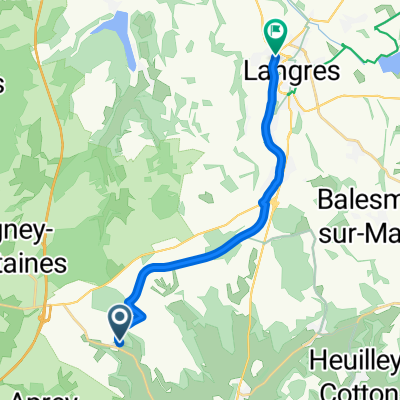
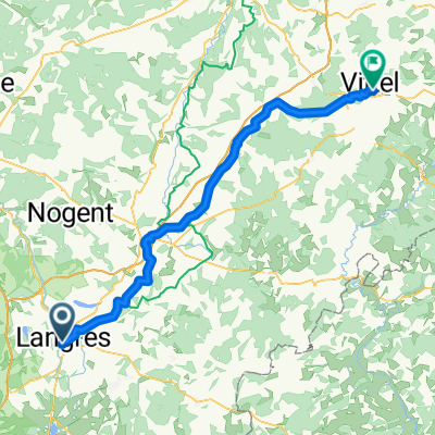
Langres-Dole
A cycling route starting in Langres, Grand Est, France.
Overview
About this route
- -:--
- Duration
- 128.2 km
- Distance
- 372 m
- Ascent
- 629 m
- Descent
- ---
- Avg. speed
- 470 m
- Max. altitude
Route quality
Waytypes & surfaces along the route
Waytypes
Track
52.6 km
(41 %)
Access road
23.1 km
(18 %)
Surfaces
Paved
91 km
(71 %)
Unpaved
9 km
(7 %)
Asphalt
84.6 km
(66 %)
Paved (undefined)
6.4 km
(5 %)
Continue with Bikemap
Use, edit, or download this cycling route
You would like to ride Langres-Dole or customize it for your own trip? Here is what you can do with this Bikemap route:
Free features
- Save this route as favorite or in collections
- Copy & plan your own version of this route
- Split it into stages to create a multi-day tour
- Sync your route with Garmin or Wahoo
Premium features
Free trial for 3 days, or one-time payment. More about Bikemap Premium.
- Navigate this route on iOS & Android
- Export a GPX / KML file of this route
- Create your custom printout (try it for free)
- Download this route for offline navigation
Discover more Premium features.
Get Bikemap PremiumFrom our community
Other popular routes starting in Langres
- Etape 6 / St geosmes _ Vesoul
- Distance
- 82.8 km
- Ascent
- 437 m
- Descent
- 738 m
- Location
- Langres, Grand Est, France
- Langres - Chevillard (3j)
- Distance
- 252.7 km
- Ascent
- 1,247 m
- Descent
- 896 m
- Location
- Langres, Grand Est, France
- Langres nach Neufchateau
- Distance
- 95.6 km
- Ascent
- 697 m
- Descent
- 877 m
- Location
- Langres, Grand Est, France
- Aadorf - Paris 6. Tag Langres - Vouécourt sur la Marne
- Distance
- 62.9 km
- Ascent
- 90 m
- Descent
- 323 m
- Location
- Langres, Grand Est, France
- B 2019 E 5 var FF sud
- Distance
- 94.5 km
- Ascent
- 235 m
- Descent
- 460 m
- Location
- Langres, Grand Est, France
- Toul Le-Puy Etappe 3 Langres - Dijon CLONED FROM ROUTE 792483
- Distance
- 88.4 km
- Ascent
- 480 m
- Descent
- 701 m
- Location
- Langres, Grand Est, France
- Tiengen - Courtenay, 2. Etappe
- Distance
- 231.2 km
- Ascent
- 1,585 m
- Descent
- 1,763 m
- Location
- Langres, Grand Est, France
- Parcours route Ross/Jojo 30/04/2016
- Distance
- 57.2 km
- Ascent
- 586 m
- Descent
- 584 m
- Location
- Langres, Grand Est, France
Open it in the app