

Altmühltal Radweg
A cycling route starting in Rothenburg upon Tauber, Bavaria, Germany.
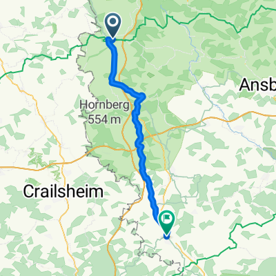
Overview
About this route
Officially
- -:--
- Duration
- 247.6 km
- Distance
- 199 m
- Ascent
- 281 m
- Descent
- ---
- Avg. speed
- ---
- Max. altitude
Route quality
Waytypes & surfaces along the route
Waytypes
Track
113.9 km
(46 %)
Quiet road
61.9 km
(25 %)
Surfaces
Paved
160.9 km
(65 %)
Unpaved
56.9 km
(23 %)
Asphalt
151 km
(61 %)
Gravel
37.1 km
(15 %)
Continue with Bikemap
Use, edit, or download this cycling route
You would like to ride Altmühltal Radweg or customize it for your own trip? Here is what you can do with this Bikemap route:
Free features
- Save this route as favorite or in collections
- Copy & plan your own version of this route
- Split it into stages to create a multi-day tour
- Sync your route with Garmin or Wahoo
Premium features
Free trial for 3 days, or one-time payment. More about Bikemap Premium.
- Navigate this route on iOS & Android
- Export a GPX / KML file of this route
- Create your custom printout (try it for free)
- Download this route for offline navigation
Discover more Premium features.
Get Bikemap PremiumFrom our community
Other popular routes starting in Rothenburg upon Tauber
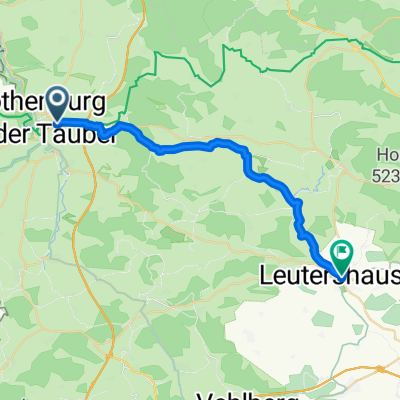 Rothenburg ob der Tauber nach Leutershausen
- Distance
- 23.3 km
- Ascent
- 214 m
- Descent
- 211 m
- Location
- Rothenburg upon Tauber, Bavaria, Germany
 Sat. 16th
- Distance
- 81.5 km
- Ascent
- 593 m
- Descent
- 701 m
- Location
- Rothenburg upon Tauber, Bavaria, Germany
 Rothenburg ob der Tauber - Nördlingen
- Distance
- 79.2 km
- Ascent
- 541 m
- Descent
- 530 m
- Location
- Rothenburg upon Tauber, Bavaria, Germany
 altmühltal
- Distance
- 137.4 km
- Ascent
- 496 m
- Descent
- 540 m
- Location
- Rothenburg upon Tauber, Bavaria, Germany
 Rothenburg-Gunzenhausen
- Distance
- 67.3 km
- Ascent
- 288 m
- Descent
- 285 m
- Location
- Rothenburg upon Tauber, Bavaria, Germany
 Rothenburg ob der Tauber - Colmberg
- Distance
- 20 km
- Ascent
- 247 m
- Descent
- 181 m
- Location
- Rothenburg upon Tauber, Bavaria, Germany
 Deutschland2027 E8
- Distance
- 70.6 km
- Ascent
- 709 m
- Descent
- 951 m
- Location
- Rothenburg upon Tauber, Bavaria, Germany
 TT8_Bierfranken_Romantische-Straße
- Distance
- 46.1 km
- Ascent
- 279 m
- Descent
- 259 m
- Location
- Rothenburg upon Tauber, Bavaria, Germany
Open it in the app