

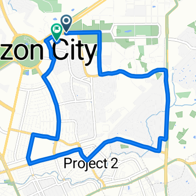
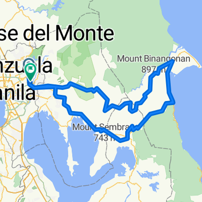
My UP Route
A cycling route starting in Quezon City, National Capital Region, Philippines.
Overview
About this route
- -:--
- Duration
- 3.4 km
- Distance
- 21 m
- Ascent
- 23 m
- Descent
- ---
- Avg. speed
- 80 m
- Max. altitude

Route quality
Waytypes & surfaces along the route
Waytypes
Quiet road
3 km
(89 %)
Road
0.3 km
(10 %)
Undefined
0 km
(1 %)
Surfaces
Paved
2.3 km
(67 %)
Concrete
2.1 km
(62 %)
Asphalt
0.2 km
(5 %)
Undefined
1.1 km
(33 %)
Continue with Bikemap
Use, edit, or download this cycling route
You would like to ride My UP Route or customize it for your own trip? Here is what you can do with this Bikemap route:
Free features
- Save this route as favorite or in collections
- Copy & plan your own version of this route
- Sync your route with Garmin or Wahoo
Premium features
Free trial for 3 days, or one-time payment. More about Bikemap Premium.
- Navigate this route on iOS & Android
- Export a GPX / KML file of this route
- Create your custom printout (try it for free)
- Download this route for offline navigation
Discover more Premium features.
Get Bikemap PremiumFrom our community
Other popular routes starting in Quezon City
 Easy ride
- Distance
- 11.4 km
- Ascent
- 68 m
- Descent
- 115 m
- Location
- Quezon City, National Capital Region, Philippines
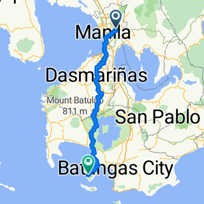 20th Avenue 169, Quezon City to PVHP+M94, Mabini
- Distance
- 159.3 km
- Ascent
- 2,625 m
- Descent
- 2,625 m
- Location
- Quezon City, National Capital Region, Philippines
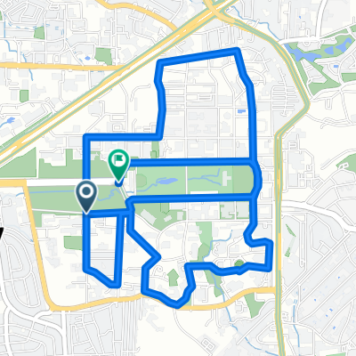
 Jog at U.P. Quezon City
- Distance
- 7.6 km
- Ascent
- 59 m
- Descent
- 73 m
- Location
- Quezon City, National Capital Region, Philippines
 APP testing, University Chill ride
- Distance
- 9.6 km
- Ascent
- 150 m
- Descent
- 165 m
- Location
- Quezon City, National Capital Region, Philippines
 ASTI Route to DOST PICEEERD
- Distance
- 24.7 km
- Ascent
- 208 m
- Descent
- 245 m
- Location
- Quezon City, National Capital Region, Philippines
 My UP Route
- Distance
- 3.4 km
- Ascent
- 21 m
- Descent
- 23 m
- Location
- Quezon City, National Capital Region, Philippines
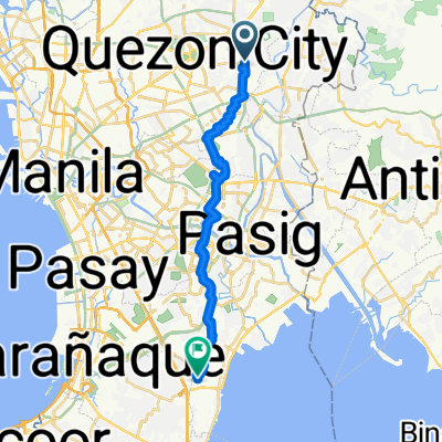
 North Perez Street to North Perez Street
- Distance
- 20.2 km
- Ascent
- 325 m
- Descent
- 324 m
- Location
- Quezon City, National Capital Region, Philippines
 NARDONG POTEK LULULULOOPS
- Distance
- 251.8 km
- Ascent
- 7,372 m
- Descent
- 7,387 m
- Location
- Quezon City, National Capital Region, Philippines
Open it in the app