

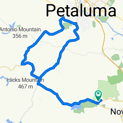
38.107° N -122.568° W to 38.117° N -122.601° W
A cycling route starting in Novato, California, United States.
Overview
About this route
- 27 min
- Duration
- 5.7 km
- Distance
- 31 m
- Ascent
- 16 m
- Descent
- 12.6 km/h
- Avg. speed
- 32 m
- Max. altitude
John Staley
created this 3 years ago
Route quality
Waytypes & surfaces along the route
Waytypes
Road
2.6 km
(46 %)
Quiet road
2.6 km
(45 %)
Surfaces
Paved
1.1 km
(19 %)
Asphalt
1.1 km
(19 %)
Undefined
4.6 km
(81 %)
Continue with Bikemap
Use, edit, or download this cycling route
You would like to ride 38.107° N -122.568° W to 38.117° N -122.601° W or customize it for your own trip? Here is what you can do with this Bikemap route:
Free features
- Save this route as favorite or in collections
- Copy & plan your own version of this route
- Sync your route with Garmin or Wahoo
Premium features
Free trial for 3 days, or one-time payment. More about Bikemap Premium.
- Navigate this route on iOS & Android
- Export a GPX / KML file of this route
- Create your custom printout (try it for free)
- Download this route for offline navigation
Discover more Premium features.
Get Bikemap PremiumFrom our community
Other popular routes starting in Novato
- marsh
- 11.1 km
- 90 m
- 88 m
- Novato, California, United States
- Latter portion of the Marin Metric from Marin High School
- 51.8 km
- 571 m
- 570 m
- Novato, California, United States
- San Marin Drive 284, Novato to San Marin Drive 284, Novato
- 0.2 km
- 0 m
- 27 m
- Novato, California, United States
- Moderate route in Novato
- 5.1 km
- 16 m
- 19 m
- Novato, California, United States
- Mount Burdell from San Marin
- 11.2 km
- 437 m
- 440 m
- Novato, California, United States
- San Marin Dr, Novato to Redwood Blvd, Novato
- 28.4 km
- 117 m
- 105 m
- Novato, California, United States


Open it in the app