Cherz-Pralongià-Cencenighe
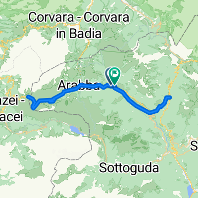
A cycling route starting in Livinallongo del Col di Lana, Veneto, Italy.
Overview
About this route
Orario inizio: 09:52 16 Ago 2022Orario fine: 15:46 16 Ago 2022Distanza: 46,3 km (05:53)Tempo movimento: 03:16Velocità media: 7,86 km/hVelocità media mov.: 14,18 km/hMax. Velocità: 52,31 km/hAltitudine minima: 761 mAltitudine massima: 2136 mVelocità di salita: 258,7 m/hVelocità di discesa: -803,2 m/hDislivello positivo: 937 mDislivello negativo: -1803 mTempo di salita: 03:37Tempo di discesa: 02:14
- -:--
- Duration
- 50 km
- Distance
- 1,856 m
- Ascent
- 2,738 m
- Descent
- ---
- Avg. speed
- 2,130 m
- Avg. speed
Route quality
Waytypes & surfaces along the route
Waytypes
Busy road
32.4 km
(65 %)
Track
8 km
(16 %)
Surfaces
Paved
36.2 km
(72 %)
Unpaved
7.1 km
(14 %)
Asphalt
33.5 km
(67 %)
Gravel
6 km
(12 %)
Continue with Bikemap
Use, edit, or download this cycling route
You would like to ride Cherz-Pralongià-Cencenighe or customize it for your own trip? Here is what you can do with this Bikemap route:
Free features
- Save this route as favorite or in collections
- Copy & plan your own version of this route
- Sync your route with Garmin or Wahoo
Premium features
Free trial for 3 days, or one-time payment. More about Bikemap Premium.
- Navigate this route on iOS & Android
- Export a GPX / KML file of this route
- Create your custom printout (try it for free)
- Download this route for offline navigation
Discover more Premium features.
Get Bikemap PremiumFrom our community
Other popular routes starting in Livinallongo del Col di Lana
- LagoDiFedaia-Ortisei
- Distance
- 41.1 km
- Ascent
- 842 m
- Descent
- 1,595 m
- Location
- Livinallongo del Col di Lana, Veneto, Italy
- Porta Vescovo - Freeride Ornella
- Distance
- 4.3 km
- Ascent
- 52 m
- Descent
- 913 m
- Location
- Livinallongo del Col di Lana, Veneto, Italy
- DO_2_Passo Valparola_CALALZO di Cadore
- Distance
- 53.6 km
- Ascent
- 90 m
- Descent
- 1,532 m
- Location
- Livinallongo del Col di Lana, Veneto, Italy
- Cherz-Pralongià-Cencenighe
- Distance
- 50 km
- Ascent
- 1,856 m
- Descent
- 2,738 m
- Location
- Livinallongo del Col di Lana, Veneto, Italy
- Dal lagazuoi al nuvolau
- Distance
- 14.6 km
- Ascent
- 806 m
- Descent
- 971 m
- Location
- Livinallongo del Col di Lana, Veneto, Italy
- Um die Civetta
- Distance
- 106.6 km
- Ascent
- 3,019 m
- Descent
- 2,946 m
- Location
- Livinallongo del Col di Lana, Veneto, Italy
- livinallongo - corvara in badia
- Distance
- 33.9 km
- Ascent
- 910 m
- Descent
- 858 m
- Location
- Livinallongo del Col di Lana, Veneto, Italy
- Marmolada - Punta Penia vom Fedaia See
- Distance
- 10.9 km
- Ascent
- 1,392 m
- Descent
- 1,394 m
- Location
- Livinallongo del Col di Lana, Veneto, Italy