

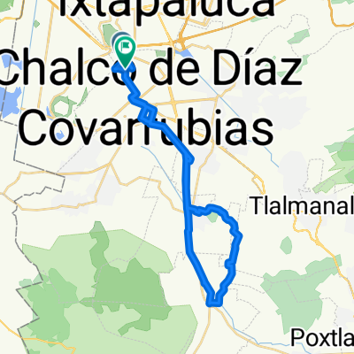
Chalco - Huajuapan de Leon
A cycling route starting in Chalco, State of Mexico, Mexico.
Overview
About this route
This route has not yet been made, but in 2012 it will surely be done !!!!
- -:--
- Duration
- 275.6 km
- Distance
- 1,904 m
- Ascent
- 2,547 m
- Descent
- ---
- Avg. speed
- ---
- Max. altitude

Continue with Bikemap
Use, edit, or download this cycling route
You would like to ride Chalco - Huajuapan de Leon or customize it for your own trip? Here is what you can do with this Bikemap route:
Free features
- Save this route as favorite or in collections
- Copy & plan your own version of this route
- Split it into stages to create a multi-day tour
- Sync your route with Garmin or Wahoo
Premium features
Free trial for 3 days, or one-time payment. More about Bikemap Premium.
- Navigate this route on iOS & Android
- Export a GPX / KML file of this route
- Create your custom printout (try it for free)
- Download this route for offline navigation
Discover more Premium features.
Get Bikemap PremiumFrom our community
Other popular routes starting in Chalco
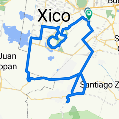
 De Oriente a Oriente
- Distance
- 47.8 km
- Ascent
- 2,292 m
- Descent
- 2,296 m
- Location
- Chalco, State of Mexico, Mexico
 De Oriente MZ.184 a Oriente
- Distance
- 41.3 km
- Ascent
- 511 m
- Descent
- 502 m
- Location
- Chalco, State of Mexico, Mexico
 Chalco - Huajuapan de Leon
- Distance
- 275.6 km
- Ascent
- 1,904 m
- Descent
- 2,547 m
- Location
- Chalco, State of Mexico, Mexico
 Calle Libramiento Arturo Montiel Rojas, Chalco de Díaz Covarrubias a Zoquiapan, Zoquiapan
- Distance
- 12.9 km
- Ascent
- 45 m
- Descent
- 13 m
- Location
- Chalco, State of Mexico, Mexico
 Privada Lote 2 21, Chalco de Díaz Covarrubias a Calle Cruz de Mayo 27, Tlalmanalco de Velázquez
- Distance
- 17.2 km
- Ascent
- 265 m
- Descent
- 71 m
- Location
- Chalco, State of Mexico, Mexico
 De Francisco I. Madero 26, Chalco de Díaz Covarrubias a Francisco I. Madero 34, Chalco de Díaz Covarrubias
- Distance
- 2.6 km
- Ascent
- 0 m
- Descent
- 0 m
- Location
- Chalco, State of Mexico, Mexico
 Calle Álvaro Obregón 16, Chalco de Díaz Covarrubias a Calle Oriente 44, Chalco de Díaz Covarrubias
- Distance
- 2.6 km
- Ascent
- 6,717 m
- Descent
- 6,723 m
- Location
- Chalco, State of Mexico, Mexico
 De Calle 9 269, Chalco de Díaz Covarrubias a Moctezuma 143, Ixtapaluca
- Distance
- 8.5 km
- Ascent
- 69 m
- Descent
- 18 m
- Location
- Chalco, State of Mexico, Mexico
Open it in the app