

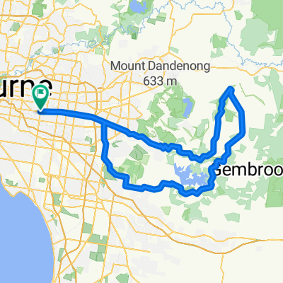
Arthurs Creek
A cycling route starting in Ashwood, Victoria, Australia.
Overview
About this route
Arthurs Creek is a classic “rouler” ride taking in the hills of north east Melbourne. Consisting of two different loops this ride can be shortened, if needed. The first loop from Warrandyte passes Kangaroo Ground, Hurstbridge, Arthurs Creek & Panton Hill. The second loop around Panton Hill is via Watsons Creek & Smith’s Gully which includes the highest climb of the day; Clintons Rd. Although the climbs are not particular daunting rest assured that by days end you will know you have completed another gruelling 6am-er classic ride.
Ride Founder: Kevin "Murph" Murphy
- -:--
- Duration
- 109.7 km
- Distance
- 812 m
- Ascent
- 812 m
- Descent
- ---
- Avg. speed
- ---
- Avg. speed

Continue with Bikemap
Use, edit, or download this cycling route
You would like to ride Arthurs Creek or customize it for your own trip? Here is what you can do with this Bikemap route:
Free features
- Save this route as favorite or in collections
- Copy & plan your own version of this route
- Sync your route with Garmin or Wahoo
Premium features
Free trial for 3 days, or one-time payment. More about Bikemap Premium.
- Navigate this route on iOS & Android
- Export a GPX / KML file of this route
- Create your custom printout (try it for free)
- Download this route for offline navigation
Discover more Premium features.
Get Bikemap PremiumFrom our community
Other popular routes starting in Ashwood
 Gruyere De Grande
- Distance
- 109.3 km
- Ascent
- 927 m
- Descent
- 928 m
- Location
- Ashwood, Victoria, Australia
 Pav-Macca
- Distance
- 124.5 km
- Ascent
- 876 m
- Descent
- 877 m
- Location
- Ashwood, Victoria, Australia
 Rhonda Van Readie
- Distance
- 108.3 km
- Ascent
- 972 m
- Descent
- 973 m
- Location
- Ashwood, Victoria, Australia
 Sorrento
- Distance
- 187.8 km
- Ascent
- 386 m
- Descent
- 386 m
- Location
- Ashwood, Victoria, Australia
 Giro d'Italia
- Distance
- 105.7 km
- Ascent
- 1,393 m
- Descent
- 1,393 m
- Location
- Ashwood, Victoria, Australia
 Hurtbox Tuesday
- Distance
- 49.8 km
- Ascent
- 96 m
- Descent
- 175 m
- Location
- Ashwood, Victoria, Australia
 Flat to Ferns
- Distance
- 120.9 km
- Ascent
- 864 m
- Descent
- 864 m
- Location
- Ashwood, Victoria, Australia
 Kinglake via Flat Rock
- Distance
- 120.6 km
- Ascent
- 1,039 m
- Descent
- 1,040 m
- Location
- Ashwood, Victoria, Australia
Open it in the app