

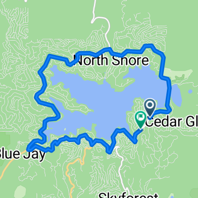
Lake Arrowhead to 850 Willow Creek Rd, Lake Arrowhead
A cycling route starting in Lake Arrowhead, California, United States.
Overview
About this route
- 1 h 25 min
- Duration
- 22.2 km
- Distance
- 446 m
- Ascent
- 449 m
- Descent
- 15.6 km/h
- Avg. speed
- 1,568 m
- Max. altitude

Route quality
Waytypes & surfaces along the route
Waytypes
Road
20.8 km
(94 %)
Quiet road
1.4 km
(6 %)
Surfaces
Paved
20.8 km
(94 %)
Paved (undefined)
20.8 km
(94 %)
Undefined
1.4 km
(6 %)
Continue with Bikemap
Use, edit, or download this cycling route
You would like to ride Lake Arrowhead to 850 Willow Creek Rd, Lake Arrowhead or customize it for your own trip? Here is what you can do with this Bikemap route:
Free features
- Save this route as favorite or in collections
- Copy & plan your own version of this route
- Sync your route with Garmin or Wahoo
Premium features
Free trial for 3 days, or one-time payment. More about Bikemap Premium.
- Navigate this route on iOS & Android
- Export a GPX / KML file of this route
- Create your custom printout (try it for free)
- Download this route for offline navigation
Discover more Premium features.
Get Bikemap PremiumFrom our community
Other popular routes starting in Lake Arrowhead
 Steady ride in Lake Arrowhead
- Distance
- 5.1 km
- Ascent
- 206 m
- Descent
- 234 m
- Location
- Lake Arrowhead, California, United States
 34.298° N -117.200° W a 34.298° N -117.200° W
- Distance
- 74.5 km
- Ascent
- 3,377 m
- Descent
- 3,391 m
- Location
- Lake Arrowhead, California, United States
 Flyer Distribution
- Distance
- 29.4 km
- Ascent
- 658 m
- Descent
- 682 m
- Location
- Lake Arrowhead, California, United States
 Lake Arrowhead Loop
- Distance
- 15 km
- Ascent
- 275 m
- Descent
- 275 m
- Location
- Lake Arrowhead, California, United States
 Lake Resort Rd, Lake Arrowhead to 28162–28166 Village Rd, Lake Arrowhead
- Distance
- 0.4 km
- Ascent
- 6 m
- Descent
- 21 m
- Location
- Lake Arrowhead, California, United States
 Hook Creek Road 30864 to California 173 16041, Hesperia
- Distance
- 38.1 km
- Ascent
- 803 m
- Descent
- 1,144 m
- Location
- Lake Arrowhead, California, United States
 Lake Arrowhead to 850 Willow Creek Rd, Lake Arrowhead
- Distance
- 22.2 km
- Ascent
- 446 m
- Descent
- 449 m
- Location
- Lake Arrowhead, California, United States
 Slow ride in
- Distance
- 2.7 km
- Ascent
- 49 m
- Descent
- 40 m
- Location
- Lake Arrowhead, California, United States
Open it in the app