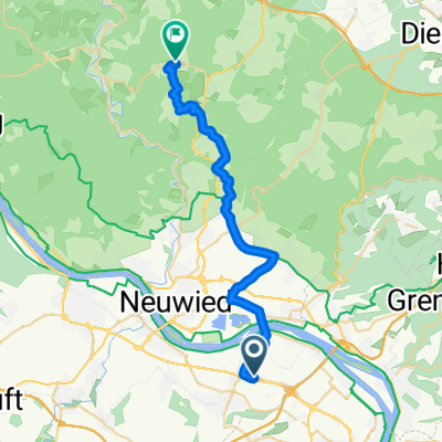
Urmitz Radfahren
- 33.5 km
- 52 m
- 71 m
- Urmitz, Rhineland-Palatinate, Germany
A cycling route starting in Urmitz, Rhineland-Palatinate, Germany.
Overview
On the cycle path sign, the fire-red mascot of the Volcanic Park, 'Vulkanius', welcomes cyclists and indicates the route of the Volcanic Park Cycle Path. Covering around 31 kilometers, the cycle path offers a journey through time into the 'hot' history of our planet's formation. From Mayen, the center of the Volcanic Eastern Eifel, through Mendig with its impressive rock cellars to the old Krahnen in Andernach, the path connects numerous volcanological and archaeological projects of the Volcanic Park. Themes along the route deal with ancient stone trade, 300,000 years of earth history in fast motion, the largest Roman tuff quarry north of the Alps, underground rock cellars, and much more. Four excursions lead off from the main route of the Volcanic Park Cycle Path and create connections to the Volcanic Park Information Center Rauschermühle in Plaidt/Saffig (Excursion - 0.6 km), the Roman quarry Meurin in Kretz (Excursion - 2.6 km), the German Volcanic Museum with the world-famous rock cellars in Mendig (Excursion - 3.2 km) and the Mayen mining field (Excursion - 0.8 km). After about three hours, the destination, the 2000-year-old bakers' town of Andernach on the Rhine, is reached. Sights along the way: - City gates and towers Mayen- Medieval city fortification- Old Town Hall in the marketplace- German slate mine- Eifelmuseum- Genovevaburg- Bürresheim Castle- Clemens Church in Mayen- Heart of Jesus Church in Mayen- LAPIDEA Sculpture Park Alternative and supplementary routes: In Mayen, the Volcanic Park Cycle Path intersects with the Maifeld Cycle Path. The segment Andernach - Weißenthurm of the Volcanic Park Cycle Path runs on the route of the Rhine Cycle Path. Bicycle-friendly hosts: Planning an overnight stay? In a hotel, a private room in a guesthouse, a holiday apartment or a holiday home in the Eifel? The bicycle-friendly hosts along the cycle path can be searched conveniently and booked online according to your wishes at Eifel Tourismus GmbH. All bicycle-friendly hosts in the Eifel can be found at www.eifel.info/radfreundliche-gastgeber.htm.
created this 3 years ago
Route quality
Quiet road
15.9 km
(25 %)
Path
15.9 km
(25 %)
Paved
47.6 km
(75 %)
Unpaved
2.5 km
(4 %)
Asphalt
46.9 km
(74 %)
Gravel
1.3 km
(2 %)
Continue with Bikemap
You would like to ride Maifeld-Radweg - Vulkanpark-Radweg von Urmitz or customize it for your own trip? Here is what you can do with this Bikemap route:
Free trial for 3 days, or one-time payment. More about Bikemap Premium.
Discover more Premium features.
Get Bikemap PremiumFrom our community
Open it in the app