

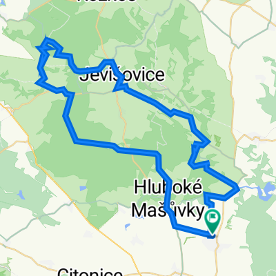
Znojmo-Přímětice-Plenkovice-Jevišovice-Plaveč
A cycling route starting in Únanov, South Moravian, Czechia.
Overview
About this route
Trip to the model airfield, through a pleasant valley to Plenkovice and from Kravsko to Jevišovice on a forest asphalt trail. From Jevišovice through the forest on a dirt road along a stream to Plavce and then along the road to the hotel in Přímětice.
- -:--
- Duration
- 41.4 km
- Distance
- 294 m
- Ascent
- 294 m
- Descent
- ---
- Avg. speed
- ---
- Max. altitude
Route quality
Waytypes & surfaces along the route
Waytypes
Track
20.3 km
(49 %)
Quiet road
5 km
(12 %)
Surfaces
Paved
9.1 km
(22 %)
Unpaved
11.2 km
(27 %)
Gravel
6.6 km
(16 %)
Asphalt
5 km
(12 %)
Route highlights
Points of interest along the route
Point of interest after 4 km
Letiště - Model City Hluboké Mašůvky
Point of interest after 22.3 km
Hrad U Suchého Čerta
Continue with Bikemap
Use, edit, or download this cycling route
You would like to ride Znojmo-Přímětice-Plenkovice-Jevišovice-Plaveč or customize it for your own trip? Here is what you can do with this Bikemap route:
Free features
- Save this route as favorite or in collections
- Copy & plan your own version of this route
- Sync your route with Garmin or Wahoo
Premium features
Free trial for 3 days, or one-time payment. More about Bikemap Premium.
- Navigate this route on iOS & Android
- Export a GPX / KML file of this route
- Create your custom printout (try it for free)
- Download this route for offline navigation
Discover more Premium features.
Get Bikemap PremiumFrom our community
Other popular routes starting in Únanov
 Znojmo-Přímětice-Plenkovice-Jevišovice-Plaveč
- Distance
- 41.4 km
- Ascent
- 294 m
- Descent
- 294 m
- Location
- Únanov, South Moravian, Czechia
 Vranovská pláž - Štítary - Vranovská Ves
- Distance
- 43.1 km
- Ascent
- 401 m
- Descent
- 401 m
- Location
- Únanov, South Moravian, Czechia
 a21
a21- Distance
- 6.9 km
- Ascent
- 123 m
- Descent
- 95 m
- Location
- Únanov, South Moravian, Czechia
 Přímětice-Mikulovice
- Distance
- 11 km
- Ascent
- 119 m
- Descent
- 137 m
- Location
- Únanov, South Moravian, Czechia
 Přímětice-Plaveč-Jevišovice-Šumná-Přímětice
- Distance
- 55.7 km
- Ascent
- 388 m
- Descent
- 393 m
- Location
- Únanov, South Moravian, Czechia
 Středně náročná trasa
- Distance
- 50 km
- Ascent
- 669 m
- Descent
- 666 m
- Location
- Únanov, South Moravian, Czechia
 Přímětice - Jevišovice - Vranov - Bítov
- Distance
- 58.9 km
- Ascent
- 542 m
- Descent
- 510 m
- Location
- Únanov, South Moravian, Czechia
 Přímětice - Hnanice - Hatě - Jaroslavice - Božice - Prosiměřice - Suchohrdly
- Distance
- 77.6 km
- Ascent
- 315 m
- Descent
- 315 m
- Location
- Únanov, South Moravian, Czechia
Open it in the app