

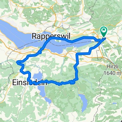
Rundtour ab Uznach-Niederurnen
A cycling route starting in Uznach, Canton of St. Gallen, Switzerland.
Overview
About this route
Starting point Uznach to Tuggen-Buttikon-Reichenburg-Niederurnen-Schänis-Uznach. Easy bike loop
- -:--
- Duration
- 35.5 km
- Distance
- 115 m
- Ascent
- 115 m
- Descent
- ---
- Avg. speed
- 442 m
- Max. altitude

Route quality
Waytypes & surfaces along the route
Waytypes
Quiet road
12.1 km
(34 %)
Track
9.2 km
(26 %)
Surfaces
Paved
28.8 km
(81 %)
Unpaved
2.8 km
(8 %)
Asphalt
24.2 km
(68 %)
Paved (undefined)
4.6 km
(13 %)
Continue with Bikemap
Use, edit, or download this cycling route
You would like to ride Rundtour ab Uznach-Niederurnen or customize it for your own trip? Here is what you can do with this Bikemap route:
Free features
- Save this route as favorite or in collections
- Copy & plan your own version of this route
- Sync your route with Garmin or Wahoo
Premium features
Free trial for 3 days, or one-time payment. More about Bikemap Premium.
- Navigate this route on iOS & Android
- Export a GPX / KML file of this route
- Create your custom printout (try it for free)
- Download this route for offline navigation
Discover more Premium features.
Get Bikemap PremiumFrom our community
Other popular routes starting in Uznach
 65 Uznach - Sattelegg - Uznach Challenge 4
- Distance
- 65.3 km
- Ascent
- 863 m
- Descent
- 861 m
- Location
- Uznach, Canton of St. Gallen, Switzerland
 CH01 -Uznach nach Bad Ragaz
- Distance
- 63.3 km
- Ascent
- 1,111 m
- Descent
- 1,085 m
- Location
- Uznach, Canton of St. Gallen, Switzerland
 Rundtour ab Uznach-Niederurnen
- Distance
- 35.5 km
- Ascent
- 115 m
- Descent
- 115 m
- Location
- Uznach, Canton of St. Gallen, Switzerland
 Rundtour Uznach, Rüeterswil, Goldingen
- Distance
- 19.6 km
- Ascent
- 451 m
- Descent
- 452 m
- Location
- Uznach, Canton of St. Gallen, Switzerland
 Einzelzeitfahren Linthebene 20km
- Distance
- 19.8 km
- Ascent
- 43 m
- Descent
- 44 m
- Location
- Uznach, Canton of St. Gallen, Switzerland
 Reichenburg (Goldegg)
- Distance
- 27 km
- Ascent
- 433 m
- Descent
- 434 m
- Location
- Uznach, Canton of St. Gallen, Switzerland
 Einzelzeitfahren Linthebene 20km
- Distance
- 19.8 km
- Ascent
- 33 m
- Descent
- 34 m
- Location
- Uznach, Canton of St. Gallen, Switzerland
 Eine Runde im Burgerwald
- Distance
- 7.1 km
- Ascent
- 249 m
- Descent
- 251 m
- Location
- Uznach, Canton of St. Gallen, Switzerland
Open it in the app