

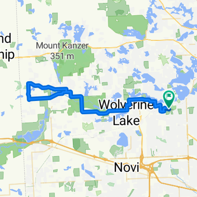
WB Trail to Kensington
A cycling route starting in West Bloomfield, Michigan, United States of America.
Overview
About this route
Slightly hilly until Kensington. A couple of big hills in Kensington area. Don't forget to stop at The Bar in downtown Milford for breakfast. Traffic light in the morning
- -:--
- Duration
- 92.5 km
- Distance
- 266 m
- Ascent
- 266 m
- Descent
- ---
- Avg. speed
- ---
- Max. altitude
Route quality
Waytypes & surfaces along the route
Waytypes
Road
73.5 km
(79 %)
Quiet road
9.7 km
(11 %)
Surfaces
Paved
18.8 km
(20 %)
Asphalt
16 km
(17 %)
Paved (undefined)
2.8 km
(3 %)
Undefined
73.6 km
(80 %)
Continue with Bikemap
Use, edit, or download this cycling route
You would like to ride WB Trail to Kensington or customize it for your own trip? Here is what you can do with this Bikemap route:
Free features
- Save this route as favorite or in collections
- Copy & plan your own version of this route
- Split it into stages to create a multi-day tour
- Sync your route with Garmin or Wahoo
Premium features
Free trial for 3 days, or one-time payment. More about Bikemap Premium.
- Navigate this route on iOS & Android
- Export a GPX / KML file of this route
- Create your custom printout (try it for free)
- Download this route for offline navigation
Discover more Premium features.
Get Bikemap PremiumFrom our community
Other popular routes starting in West Bloomfield
 Wheels to the road (WTTR) - RAC loop
- Distance
- 10 km
- Ascent
- 33 m
- Descent
- 35 m
- Location
- West Bloomfield, Michigan, United States of America
 Maple Lakes Drive 6718, West Bloomfield Township to Verona Street 7466, West Bloomfield Township
- Distance
- 63.3 km
- Ascent
- 265 m
- Descent
- 286 m
- Location
- West Bloomfield, Michigan, United States of America
 Wheels to the Road (WTTR) - Orchard Mall loop
- Distance
- 8.4 km
- Ascent
- 34 m
- Descent
- 35 m
- Location
- West Bloomfield, Michigan, United States of America
 WB Trail to Kensington Park loop
- Distance
- 63.5 km
- Ascent
- 385 m
- Descent
- 386 m
- Location
- West Bloomfield, Michigan, United States of America
 WB to GM Proving Grounds
- Distance
- 62.1 km
- Ascent
- 167 m
- Descent
- 170 m
- Location
- West Bloomfield, Michigan, United States of America
 Wheels to the road (WTTR) - Pleasant loop
- Distance
- 6.9 km
- Ascent
- 45 m
- Descent
- 42 m
- Location
- West Bloomfield, Michigan, United States of America
 Browning Drive - Deer Run Circle
- Distance
- 9 km
- Ascent
- 84 m
- Descent
- 79 m
- Location
- West Bloomfield, Michigan, United States of America
 DVT WAM Training
- Distance
- 40.2 km
- Ascent
- 119 m
- Descent
- 120 m
- Location
- West Bloomfield, Michigan, United States of America
Open it in the app