

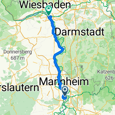
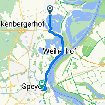
Umleitung_Otterstadt-Waldsee
A cycling route starting in Otterstadt, Rhineland-Palatinate, Germany.
Overview
About this route
from March 2007: Due to construction work on the levee path, the Rhine cycling path / Veloroute Rhein is diverted through Otterstadt and Waldsee to Altrip until further notice.
Since July 2008, it is no longer necessary to use this detour to travel the Veloroute Rhein = Rhine cycling path; one can again ride directly on the Veloroute Rhein / Rhine cycling path.
- -:--
- Duration
- 12.2 km
- Distance
- 35 m
- Ascent
- 32 m
- Descent
- ---
- Avg. speed
- 105 m
- Max. altitude

Route quality
Waytypes & surfaces along the route
Waytypes
Track
6.1 km
(50 %)
Path
1.8 km
(15 %)
Surfaces
Paved
12.2 km
(100 %)
Asphalt
11.7 km
(96 %)
Paved (undefined)
0.5 km
(4 %)
Route highlights
Points of interest along the route
Photo after 0.2 km
Beginn der Umleitung
Photo after 9.1 km
Ende der Umleitung
Continue with Bikemap
Use, edit, or download this cycling route
You would like to ride Umleitung_Otterstadt-Waldsee or customize it for your own trip? Here is what you can do with this Bikemap route:
Free features
- Save this route as favorite or in collections
- Copy & plan your own version of this route
- Sync your route with Garmin or Wahoo
Premium features
Free trial for 3 days, or one-time payment. More about Bikemap Premium.
- Navigate this route on iOS & Android
- Export a GPX / KML file of this route
- Create your custom printout (try it for free)
- Download this route for offline navigation
Discover more Premium features.
Get Bikemap PremiumFrom our community
Other popular routes starting in Otterstadt
 Camping Kollersee nach Speyer zum Alten Hammer
- Distance
- 10.2 km
- Ascent
- 11 m
- Descent
- 59 m
- Location
- Otterstadt, Rhineland-Palatinate, Germany
 Rollerski- bzw. Inlinerroute am Rheindamm Otterstadt -> Altrip
- Distance
- 8.8 km
- Ascent
- 16 m
- Descent
- 16 m
- Location
- Otterstadt, Rhineland-Palatinate, Germany
 Nackenheim - Oberdiebach
- Distance
- 101.8 km
- Ascent
- 256 m
- Descent
- 266 m
- Location
- Otterstadt, Rhineland-Palatinate, Germany
 Rettich-Rhein-Tour
- Distance
- 36.1 km
- Ascent
- 56 m
- Descent
- 59 m
- Location
- Otterstadt, Rhineland-Palatinate, Germany
 Wachenheim Kalmit Modenbachtal Ramberg
- Distance
- 137.9 km
- Ascent
- 1,185 m
- Descent
- 1,183 m
- Location
- Otterstadt, Rhineland-Palatinate, Germany
 Stickelspitzer-Kraftwerks-Rundfahrt
- Distance
- 20.5 km
- Ascent
- 50 m
- Descent
- 54 m
- Location
- Otterstadt, Rhineland-Palatinate, Germany
 Umleitung_Otterstadt-Waldsee
- Distance
- 12.2 km
- Ascent
- 35 m
- Descent
- 32 m
- Location
- Otterstadt, Rhineland-Palatinate, Germany
 Speyer Domplatz
- Distance
- 7 km
- Ascent
- 13 m
- Descent
- 10 m
- Location
- Otterstadt, Rhineland-Palatinate, Germany
Open it in the app