

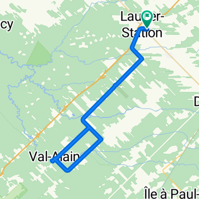
Gare St Agapit - Centre des Congrès Lévis
A cycling route starting in Saint-Antoine-de-Tilly, Quebec, Canada.
Overview
About this route
Gare St Agapit - Levis Centre des congrès
- -:--
- Duration
- 43 km
- Distance
- 212 m
- Ascent
- 268 m
- Descent
- ---
- Avg. speed
- 124 m
- Max. altitude

Route quality
Waytypes & surfaces along the route
Waytypes
Cycleway
30.8 km
(72 %)
Road
6 km
(14 %)
Surfaces
Paved
33.3 km
(77 %)
Unpaved
6.4 km
(15 %)
Asphalt
25.8 km
(60 %)
Paved (undefined)
7.5 km
(18 %)
Continue with Bikemap
Use, edit, or download this cycling route
You would like to ride Gare St Agapit - Centre des Congrès Lévis or customize it for your own trip? Here is what you can do with this Bikemap route:
Free features
- Save this route as favorite or in collections
- Copy & plan your own version of this route
- Sync your route with Garmin or Wahoo
Premium features
Free trial for 3 days, or one-time payment. More about Bikemap Premium.
- Navigate this route on iOS & Android
- Export a GPX / KML file of this route
- Create your custom printout (try it for free)
- Download this route for offline navigation
Discover more Premium features.
Get Bikemap PremiumFrom our community
Other popular routes starting in Saint-Antoine-de-Tilly
 Domaine Joly-de-Lotbinière, 67 km
- Distance
- 67.2 km
- Ascent
- 225 m
- Descent
- 220 m
- Location
- Saint-Antoine-de-Tilly, Quebec, Canada
 Lotbinière Fleuve et terroir v2
- Distance
- 71.5 km
- Ascent
- 188 m
- Descent
- 188 m
- Location
- Saint-Antoine-de-Tilly, Quebec, Canada
 Av-1 Laurier-Station 75 km
- Distance
- 75.2 km
- Ascent
- 72 m
- Descent
- 74 m
- Location
- Saint-Antoine-de-Tilly, Quebec, Canada
 St-Agapit - sortie cyclosportive
- Distance
- 79.7 km
- Ascent
- 225 m
- Descent
- 227 m
- Location
- Saint-Antoine-de-Tilly, Quebec, Canada
 Rando Lotbinière à vélo 2019 La Populaire
- Distance
- 52.2 km
- Ascent
- 63 m
- Descent
- 63 m
- Location
- Saint-Antoine-de-Tilly, Quebec, Canada
 Gare St Agapit - Centre des Congrès Lévis
- Distance
- 43 km
- Ascent
- 212 m
- Descent
- 268 m
- Location
- Saint-Antoine-de-Tilly, Quebec, Canada
 Av-3 Laurier-Station 44 km
- Distance
- 43.5 km
- Ascent
- 64 m
- Descent
- 65 m
- Location
- Saint-Antoine-de-Tilly, Quebec, Canada
 Randonnée Lotbinière à vélo
- Distance
- 80.3 km
- Ascent
- 221 m
- Descent
- 223 m
- Location
- Saint-Antoine-de-Tilly, Quebec, Canada
Open it in the app