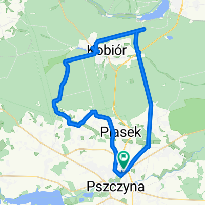
Pszczyna - Żar - Żywiec - Pszczyna
A cycling route starting in Pszczyna, Silesian Voivodeship, Poland.
Overview
About this route
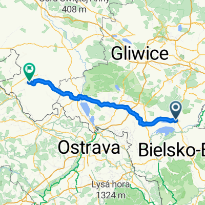
Pszczyna - Brzeszcze - Wilamowice - Kęty - Międzybrodzie - Żar (761 m above sea level) - Czernichów - Żywiec - Bielsko-Biała - Czechowice-Dziedzice - Zabrzeg - Pszczyna
- -:--
- Duration
- 126.1 km
- Distance
- 651 m
- Ascent
- 653 m
- Descent
- ---
- Avg. speed
- ---
- Max. altitude
Route quality
Waytypes & surfaces along the route
Waytypes
Road
40.3 km
(32 %)
Quiet road
32.8 km
(26 %)
Surfaces
Paved
93.3 km
(74 %)
Unpaved
2.5 km
(2 %)
Asphalt
92 km
(73 %)
Ground
2.5 km
(2 %)
Continue with Bikemap
Use, edit, or download this cycling route
You would like to ride Pszczyna - Żar - Żywiec - Pszczyna or customize it for your own trip? Here is what you can do with this Bikemap route:
Free features
- Save this route as favorite or in collections
- Copy & plan your own version of this route
- Split it into stages to create a multi-day tour
- Sync your route with Garmin or Wahoo
Premium features
Free trial for 3 days, or one-time payment. More about Bikemap Premium.
- Navigate this route on iOS & Android
- Export a GPX / KML file of this route
- Create your custom printout (try it for free)
- Download this route for offline navigation
Discover more Premium features.
Get Bikemap PremiumFrom our community
Other popular routes starting in Pszczyna
Pszczyna-Jawiszowice- Distance
- 48.8 km
- Ascent
- 134 m
- Descent
- 134 m
- Location
- Pszczyna, Silesian Voivodeship, Poland
Pszczyna-Skoczów- Distance
- 28.3 km
- Ascent
- 134 m
- Descent
- 88 m
- Location
- Pszczyna, Silesian Voivodeship, Poland
Trasa z Łowiecka, Pszczyna- Distance
- 18.5 km
- Ascent
- 62 m
- Descent
- 71 m
- Location
- Pszczyna, Silesian Voivodeship, Poland
Pszczyna-Mikołów- Distance
- 28.5 km
- Ascent
- 219 m
- Descent
- 175 m
- Location
- Pszczyna, Silesian Voivodeship, Poland
Pszczyna - Żar - Żywiec - Pszczyna- Distance
- 126.1 km
- Ascent
- 651 m
- Descent
- 653 m
- Location
- Pszczyna, Silesian Voivodeship, Poland
Pszczyna - dookoła jeziora Goczałkowickiego- Distance
- 50 km
- Ascent
- 89 m
- Descent
- 92 m
- Location
- Pszczyna, Silesian Voivodeship, Poland
Pszczyna - dookoła jeziora Goczałkowickiego- Distance
- 46.3 km
- Ascent
- 96 m
- Descent
- 96 m
- Location
- Pszczyna, Silesian Voivodeship, Poland
Pszczyna-Miedzna-Jawiszowice- Distance
- 44.8 km
- Ascent
- 105 m
- Descent
- 104 m
- Location
- Pszczyna, Silesian Voivodeship, Poland
Open it in the app


