
![[Planung] RS13 KA-RA Durchfahrt Durmersheim Variante gelb](https://media.bikemap.net/routes/11772026/staticmaps/in_27ef0e0d-5dbd-4932-9418-b904cac42b74_694x400_bikemap-2021-3D-static.png)


Bietigheim-KA durch den Hardtwald
- 23.1 km
- 12 m
- 8 m
- Bietigheim, Baden-Wurttemberg, Germany
A cycling route starting in Bietigheim, Baden-Wurttemberg, Germany.
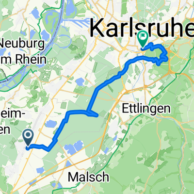
Overview
NOTE: This route is part of the planning of RS13. This RS does not exist yet!
(YELLOW) from Bietighium Langgewann to the industrial area south of Malscher Straße, at Am Moserareal, Industriestraße to D'heim Nord, continuing on Helmholtzstraße.
created this 3 years ago
Route quality
Quiet road
2.7 km
(61 %)
Track
1.1 km
(26 %)
Paved
3.1 km
(71 %)
Unpaved
0.9 km
(21 %)
Asphalt
3.1 km
(70 %)
Gravel
0.9 km
(20 %)
Continue with Bikemap
You would like to ride [Planung] RS13 KA-RA Durchfahrt Durmersheim Variante gelb or customize it for your own trip? Here is what you can do with this Bikemap route:
Free trial for 3 days, or one-time payment. More about Bikemap Premium.
Discover more Premium features.
Get Bikemap PremiumFrom our community
Open it in the app


![[Planung] RS13 KA-RA Durchfahrt Durmersheim Variante gelb](https://media.bikemap.net/routes/11772026/staticmaps/in_27ef0e0d-5dbd-4932-9418-b904cac42b74_400x400_bikemap-2021-3D-static.png)


