

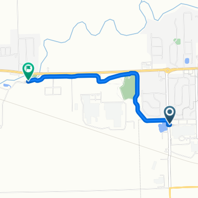
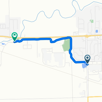
Warsaw to Tippycanoe State Park
A cycling route starting in Warsaw, Indiana, United States.
Overview
About this route
- -:--
- Duration
- 80 km
- Distance
- 27 m
- Ascent
- 52 m
- Descent
- ---
- Avg. speed
- 267 m
- Max. altitude
Route quality
Waytypes & surfaces along the route
Waytypes
Quiet road
60 km
(75 %)
Road
16 km
(20 %)
Surfaces
Paved
5.6 km
(7 %)
Paved (undefined)
5.6 km
(7 %)
Undefined
74.4 km
(93 %)
Route highlights
Points of interest along the route
Point of interest after 1.3 km
Point of interest after 1.5 km
bike trail
Point of interest after 3.4 km
crosses tippy river
Continue with Bikemap
Use, edit, or download this cycling route
You would like to ride Warsaw to Tippycanoe State Park or customize it for your own trip? Here is what you can do with this Bikemap route:
Free features
- Save this route as favorite or in collections
- Copy & plan your own version of this route
- Sync your route with Garmin or Wahoo
Premium features
Free trial for 3 days, or one-time payment. More about Bikemap Premium.
- Navigate this route on iOS & Android
- Export a GPX / KML file of this route
- Create your custom printout (try it for free)
- Download this route for offline navigation
Discover more Premium features.
Get Bikemap PremiumFrom our community
Other popular routes starting in Warsaw
 West Center Street to West North
- Distance
- 3 km
- Ascent
- 0 m
- Descent
- 5 m
- Location
- Warsaw, Indiana, United States
 To mentone In.
- Distance
- 41.9 km
- Ascent
- 40 m
- Descent
- 38 m
- Location
- Warsaw, Indiana, United States
 Warmup Route
- Distance
- 3 km
- Ascent
- ---
- Descent
- ---
- Location
- Warsaw, Indiana, United States
 Recovered Route
- Distance
- 1.6 km
- Ascent
- 3 m
- Descent
- 7 m
- Location
- Warsaw, Indiana, United States
 Recovered Route
- Distance
- 10.8 km
- Ascent
- 29 m
- Descent
- 28 m
- Location
- Warsaw, Indiana, United States
 After Work
- Distance
- 3 km
- Ascent
- 0 m
- Descent
- 5 m
- Location
- Warsaw, Indiana, United States
 Warsaw to Tippycanoe State Park
- Distance
- 80 km
- Ascent
- 27 m
- Descent
- 52 m
- Location
- Warsaw, Indiana, United States
 West Center Street to Hepler Drive
- Distance
- 6.4 km
- Ascent
- 31 m
- Descent
- 6 m
- Location
- Warsaw, Indiana, United States
Open it in the app