

Sunnhordland - The Islands South of Bergen
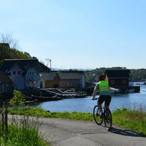
Haaheim Gaard - Leirvik
A cycling route starting in Uggdal, Hordaland, Norway.
Overview
About this route
The distance include a ferry, about 2 km. Distansen inkluderer en ferje ca. 2 km.
- 2 h 38 min
- Duration
- 36.9 km
- Distance
- 809 m
- Ascent
- 918 m
- Descent
- 14 km/h
- Avg. speed
- 166 m
- Max. altitude

Part of
Route quality
Waytypes & surfaces along the route
Waytypes
Cycleway
9.2 km
(25 %)
Quiet road
3.7 km
(10 %)
Surfaces
Paved
24 km
(65 %)
Asphalt
24 km
(65 %)
Undefined
12.9 km
(35 %)
Continue with Bikemap
Use, edit, or download this cycling route
You would like to ride Haaheim Gaard - Leirvik or customize it for your own trip? Here is what you can do with this Bikemap route:
Free features
- Save this route as favorite or in collections
- Copy & plan your own version of this route
- Sync your route with Garmin or Wahoo
Premium features
Free trial for 3 days, or one-time payment. More about Bikemap Premium.
- Navigate this route on iOS & Android
- Export a GPX / KML file of this route
- Create your custom printout (try it for free)
- Download this route for offline navigation
Discover more Premium features.
Get Bikemap PremiumFrom our community
Other popular routes starting in Uggdal
 Tysnes loop
- Distance
- 59.1 km
- Ascent
- 629 m
- Descent
- 629 m
- Location
- Uggdal, Hordaland, Norway
 Tysnes
- Distance
- 148 km
- Ascent
- 943 m
- Descent
- 940 m
- Location
- Uggdal, Hordaland, Norway
 Uggdal Cycling
- Distance
- 53.9 km
- Ascent
- 891 m
- Descent
- 891 m
- Location
- Uggdal, Hordaland, Norway
 Tysnes, Hardanger, Tysse, Os, Kalandsvannet, Os
- Distance
- 205.5 km
- Ascent
- 1,299 m
- Descent
- 1,298 m
- Location
- Uggdal, Hordaland, Norway
 Tysnes: Malkenes kai - Haaheim Gard
- Distance
- 19.1 km
- Ascent
- 423 m
- Descent
- 288 m
- Location
- Uggdal, Hordaland, Norway
 Sunnhordland: Tysnes rundt CLONED FROM ROUTE 1361229
- Distance
- 43.5 km
- Ascent
- 243 m
- Descent
- 243 m
- Location
- Uggdal, Hordaland, Norway
 uggdal-haugesund
- Distance
- 115.5 km
- Ascent
- 612 m
- Descent
- 643 m
- Location
- Uggdal, Hordaland, Norway
 Haaheim Gaard - Leirvik
- Distance
- 37.1 km
- Ascent
- 791 m
- Descent
- 901 m
- Location
- Uggdal, Hordaland, Norway
Open it in the app