Kal Haven Trail, South Haven to 200 E Michigan Ave, Galesburg
A cycling route starting in South Haven, Michigan, United States of America.
Overview
About this route
- 5 h 27 min
- Duration
- 78.4 km
- Distance
- 350 m
- Ascent
- 295 m
- Descent
- 14.4 km/h
- Avg. speed
- 297 m
- Avg. speed
Route quality
Waytypes & surfaces along the route
Waytypes
Cycleway
71.9 km
(92 %)
Road
3.2 km
(4 %)
Surfaces
Paved
14.3 km
(18 %)
Unpaved
49.8 km
(64 %)
Unpaved (undefined)
49.8 km
(64 %)
Asphalt
12.6 km
(16 %)
Continue with Bikemap
Use, edit, or download this cycling route
You would like to ride Kal Haven Trail, South Haven to 200 E Michigan Ave, Galesburg or customize it for your own trip? Here is what you can do with this Bikemap route:
Free features
- Save this route as favorite or in collections
- Copy & plan your own version of this route
- Sync your route with Garmin or Wahoo
Premium features
Free trial for 3 days, or one-time payment. More about Bikemap Premium.
- Navigate this route on iOS & Android
- Export a GPX / KML file of this route
- Create your custom printout (try it for free)
- Download this route for offline navigation
Discover more Premium features.
Get Bikemap PremiumFrom our community
Other popular routes starting in South Haven
- Lake MI route #1
- Distance
- 406.9 km
- Ascent
- 275 m
- Descent
- 301 m
- Location
- South Haven, Michigan, United States of America
- Day 2: South Haven > Pentwater
- Distance
- 203 km
- Ascent
- 231 m
- Descent
- 212 m
- Location
- South Haven, Michigan, United States of America
- Great Lake-to-Lake Trails Route #1
- Distance
- 426.8 km
- Ascent
- 353 m
- Descent
- 352 m
- Location
- South Haven, Michigan, United States of America
- Pinnacle Drive 7367, South Haven to Fredericksburg Road 36215, Farmington Hills
- Distance
- 292.1 km
- Ascent
- 1,127 m
- Descent
- 1,063 m
- Location
- South Haven, Michigan, United States of America
- South Haven to 2855 29th St SE, Kentwood
- Distance
- 111.3 km
- Ascent
- 479 m
- Descent
- 430 m
- Location
- South Haven, Michigan, United States of America
- 11533 76th St, South Haven to 11533 76th St, South Haven
- Distance
- 13.3 km
- Ascent
- 39 m
- Descent
- 49 m
- Location
- South Haven, Michigan, United States of America
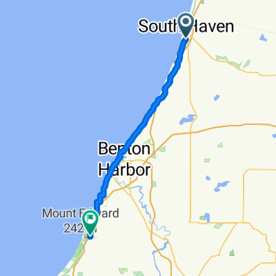
- 351 Cherry St, South Haven to 351 Cherry St, South Haven
- Distance
- 18.8 km
- Ascent
- 85 m
- Descent
- 87 m
- Location
- South Haven, Michigan, United States of America
- 500 Phoenix St, South Haven to 37–59 Lakeshore Dr, South Haven
- Distance
- 3 km
- Ascent
- 10 m
- Descent
- 16 m
- Location
- South Haven, Michigan, United States of America
Open it in the app