

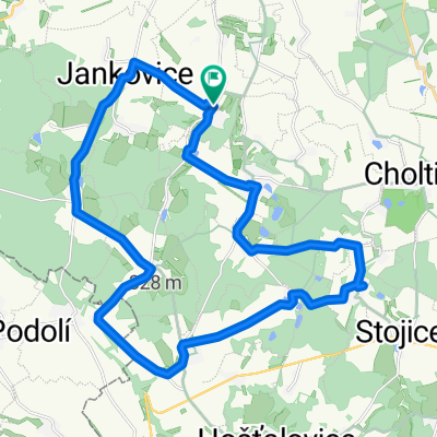
Pardubice_Hradec_Prelouc_Opatovice Kanal
A cycling route starting in Přelouč, Pardubický kraj, Czechia.
Overview
About this route
Rundtour entlang des opatovice Kanals
- -:--
- Duration
- 63.8 km
- Distance
- 252 m
- Ascent
- 252 m
- Descent
- ---
- Avg. speed
- 252 m
- Max. altitude
Route quality
Waytypes & surfaces along the route
Waytypes
Road
31.2 km
(49 %)
Track
8.9 km
(14 %)
Surfaces
Paved
19.8 km
(31 %)
Unpaved
7.7 km
(12 %)
Asphalt
18.5 km
(29 %)
Gravel
4.5 km
(7 %)
Continue with Bikemap
Use, edit, or download this cycling route
You would like to ride Pardubice_Hradec_Prelouc_Opatovice Kanal or customize it for your own trip? Here is what you can do with this Bikemap route:
Free features
- Save this route as favorite or in collections
- Copy & plan your own version of this route
- Sync your route with Garmin or Wahoo
Premium features
Free trial for 3 days, or one-time payment. More about Bikemap Premium.
- Navigate this route on iOS & Android
- Export a GPX / KML file of this route
- Create your custom printout (try it for free)
- Download this route for offline navigation
Discover more Premium features.
Get Bikemap PremiumFrom our community
Other popular routes starting in Přelouč
 Kocourkovské kolečko II
- Distance
- 49.4 km
- Ascent
- 451 m
- Descent
- 448 m
- Location
- Přelouč, Pardubický kraj, Czechia
 Přelouč Lepějovice Choltice Březinka Litošice Přelouč
- Distance
- 40.7 km
- Ascent
- 332 m
- Descent
- 332 m
- Location
- Přelouč, Pardubický kraj, Czechia
 Cyklovýlet na zámek Choltice
- Distance
- 29.4 km
- Ascent
- 258 m
- Descent
- 211 m
- Location
- Přelouč, Pardubický kraj, Czechia
 Gran Premio Monti di Ferro 2019
- Distance
- 119.7 km
- Ascent
- 1,062 m
- Descent
- 1,062 m
- Location
- Přelouč, Pardubický kraj, Czechia
 z Brlohu do Brlohu
- Distance
- 25.7 km
- Ascent
- 0 m
- Descent
- 0 m
- Location
- Přelouč, Pardubický kraj, Czechia
 kolečko Přelouč - Semtěš - Morašice - Přelouč
- Distance
- 30.4 km
- Ascent
- 322 m
- Descent
- 323 m
- Location
- Přelouč, Pardubický kraj, Czechia
 Pardubice_Hradec_Prelouc_Opatovice Kanal
- Distance
- 63.8 km
- Ascent
- 252 m
- Descent
- 252 m
- Location
- Přelouč, Pardubický kraj, Czechia
 Iron Mountains Open Air Training Camp 2013
- Distance
- 77.2 km
- Ascent
- 774 m
- Descent
- 774 m
- Location
- Přelouč, Pardubický kraj, Czechia
Open it in the app