Up to the tower
A cycling route starting in Amélie-les-Bains, Languedoc-Roussillon-Midi-Pyrénées, France.
Overview
About this route
The uphill is on a paved road, just the last 2km are unpaved. The top of the tour is marked by an old stone tower, the view is stunning!!!! From there you go down on old miners roads. Ever thought your bike's suspension parts are good? Well, if they survive the first part of the downhill, they really are. Nevertheless, the downhill is bumpy, but not difficult. You pass old mines and end up in Amelie les bains. If you want, there are a few options to do the downhill on singletrails, but be warned: the trails are washed out and rocky, I don't recommend them.
- -:--
- Duration
- 43.7 km
- Distance
- 1,217 m
- Ascent
- 1,206 m
- Descent
- ---
- Avg. speed
- ---
- Avg. speed
Route quality
Waytypes & surfaces along the route
Waytypes
Quiet road
15.9 km
(36 %)
Road
11.3 km
(26 %)
Surfaces
Paved
15.5 km
(35 %)
Unpaved
11.9 km
(27 %)
Asphalt
15.5 km
(35 %)
Gravel
11.1 km
(26 %)
Route highlights
Points of interest along the route
Point of interest after 9.2 km
Geheimnisvolle alte Kirche, sehenswert!!
Point of interest after 25.1 km
Old stone tower, the top of the tour. Great view!!!
Point of interest after 33.7 km
Possibility to take the dangerous singletrail.
Continue with Bikemap
Use, edit, or download this cycling route
You would like to ride Up to the tower or customize it for your own trip? Here is what you can do with this Bikemap route:
Free features
- Save this route as favorite or in collections
- Copy & plan your own version of this route
- Sync your route with Garmin or Wahoo
Premium features
Free trial for 3 days, or one-time payment. More about Bikemap Premium.
- Navigate this route on iOS & Android
- Export a GPX / KML file of this route
- Create your custom printout (try it for free)
- Download this route for offline navigation
Discover more Premium features.
Get Bikemap PremiumFrom our community
Other popular routes starting in Amélie-les-Bains
- Amélie-les-Bains-Palalda to Perpignan (Rivesaltes)
- Distance
- 56.3 km
- Ascent
- 438 m
- Descent
- 642 m
- Location
- Amélie-les-Bains, Languedoc-Roussillon-Midi-Pyrénées, France
- De Rue de la Riviera 40, Amélie-les-Bains-Palalda à Rue de la Riviera 38, Amélie-les-Bains-Palalda
- Distance
- 21.4 km
- Ascent
- 269 m
- Descent
- 275 m
- Location
- Amélie-les-Bains, Languedoc-Roussillon-Midi-Pyrénées, France
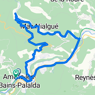
- De Rue de la Riviera 38, Amélie-les-Bains-Palalda à Rue de la Riviera 40, Amélie-les-Bains-Palalda
- Distance
- 17.4 km
- Ascent
- 514 m
- Descent
- 503 m
- Location
- Amélie-les-Bains, Languedoc-Roussillon-Midi-Pyrénées, France
- Pyrenäen - sur Tech
- Distance
- 34 km
- Ascent
- 1,412 m
- Descent
- 217 m
- Location
- Amélie-les-Bains, Languedoc-Roussillon-Midi-Pyrénées, France
- Amélie les Bains-Ripoll. Marzo 2017
- Distance
- 77.9 km
- Ascent
- 1,296 m
- Descent
- 824 m
- Location
- Amélie-les-Bains, Languedoc-Roussillon-Midi-Pyrénées, France
- 8. Etape traversée des Pyrenées 2011
- Distance
- 66.8 km
- Ascent
- 540 m
- Descent
- 856 m
- Location
- Amélie-les-Bains, Languedoc-Roussillon-Midi-Pyrénées, France
- Up to the tower
- Distance
- 43.7 km
- Ascent
- 1,217 m
- Descent
- 1,206 m
- Location
- Amélie-les-Bains, Languedoc-Roussillon-Midi-Pyrénées, France
- 28 La Bastide, La Bastide Ă 28 La Bastide, La Bastide
- Distance
- 71.9 km
- Ascent
- 2,621 m
- Descent
- 2,621 m
- Location
- Amélie-les-Bains, Languedoc-Roussillon-Midi-Pyrénées, France
Open it in the app