

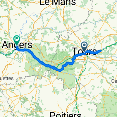
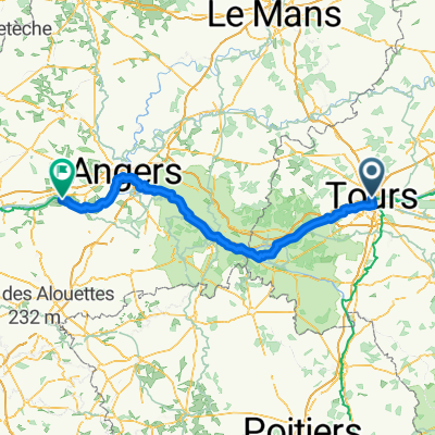
Girolibero: Castelli della Loira da Tours a Tours
A cycling route starting in Tours, Centre-Val de Loire, France.
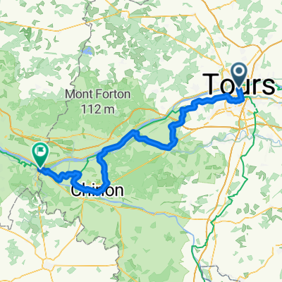
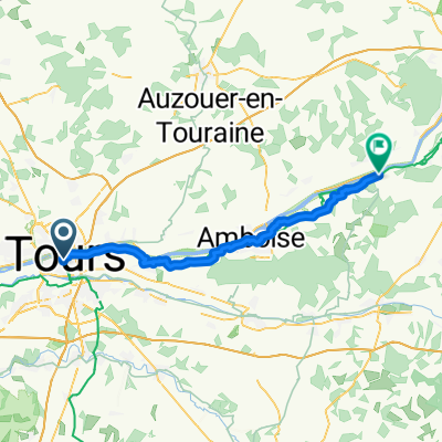
Overview
About this route
Accommodation: Tours, Chinon, Saumur, Azay-le-Rideau, Chenonceaux, Blois
Route: the tour follows small, little-trafficked, flat roads, interrupted by short hilly sections. - -:--
- Duration
- 305.3 km
- Distance
- 1,643 m
- Ascent
- 1,643 m
- Descent
- ---
- Avg. speed
- 132 m
- Max. altitude

Route quality
Waytypes & surfaces along the route
Waytypes
Road
36.6 km
(12 %)
Quiet road
15.3 km
(5 %)
Surfaces
Paved
171 km
(56 %)
Asphalt
171 km
(56 %)
Undefined
134.3 km
(44 %)
Route highlights
Points of interest along the route
Point of interest after 28.5 km
castello di Langeais
Point of interest after 43.2 km
castello di Ussè
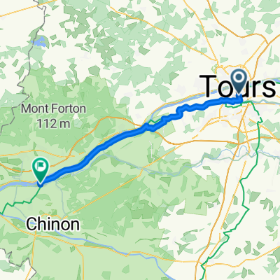
Accommodation after 55.7 km
Chinon
Accommodation after 88.3 km
Saumur
Accommodation after 142.2 km
Azay-le-Rideau
Point of interest after 152.3 km
castello di Villandry
Accommodation after 200.7 km
Chenonceaux
Point of interest after 229.5 km
castello di Chaumont
Accommodation after 244.7 km
Blois
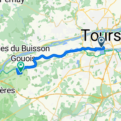
Point of interest after 278.6 km
castello di Amboise
Accommodation after 305.2 km
Tours
Continue with Bikemap
Use, edit, or download this cycling route
You would like to ride Girolibero: Castelli della Loira da Tours a Tours or customize it for your own trip? Here is what you can do with this Bikemap route:
Free features
- Save this route as favorite or in collections
- Copy & plan your own version of this route
- Split it into stages to create a multi-day tour
- Sync your route with Garmin or Wahoo
Premium features
Free trial for 3 days, or one-time payment. More about Bikemap Premium.
- Navigate this route on iOS & Android
- Export a GPX / KML file of this route
- Create your custom printout (try it for free)
- Download this route for offline navigation
Discover more Premium features.
Get Bikemap PremiumFrom our community
Other popular routes starting in Tours
 Day 3 - Tours - Saumur
- Distance
- 80.2 km
- Ascent
- 383 m
- Descent
- 406 m
- Location
- Tours, Centre-Val de Loire, France
 Loire Bike Tour
- Distance
- 200.6 km
- Ascent
- 1,311 m
- Descent
- 1,319 m
- Location
- Tours, Centre-Val de Loire, France
 Tours - La Chapelle-sur-Loire
- Distance
- 45.6 km
- Ascent
- 123 m
- Descent
- 137 m
- Location
- Tours, Centre-Val de Loire, France
 Rue du Chemin de Fer - Chemin de l'Audience
- Distance
- 19.1 km
- Ascent
- 51 m
- Descent
- 87 m
- Location
- Tours, Centre-Val de Loire, France
 Tours - Châtellerault
- Distance
- 88.8 km
- Ascent
- 337 m
- Descent
- 335 m
- Location
- Tours, Centre-Val de Loire, France
 From Tours to Mauges-sur-Loire
- Distance
- 170.9 km
- Ascent
- 884 m
- Descent
- 931 m
- Location
- Tours, Centre-Val de Loire, France
 Von Tours bis Montsoreau
- Distance
- 89.3 km
- Ascent
- 437 m
- Descent
- 439 m
- Location
- Tours, Centre-Val de Loire, France
 From Tours to Chaumont-sur-Loire
- Distance
- 48.9 km
- Ascent
- 322 m
- Descent
- 296 m
- Location
- Tours, Centre-Val de Loire, France
Open it in the app