

The Vale
A cycling route starting in Ashwood, Victoria, Australia.
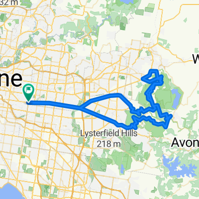
Overview
About this route
The Vale is one of the monster rides in the 6am-ers kit bag. Usually tackled in the leadup to the Warny it heads to the famous Humvale Hill.
This is the only ride without the obligatory coffee stop, partly due to the distance but also to force you to carry food & eat on the run simulating all the intricacies of the<span class="st"></span> Warny.
- -:--
- Duration
- 141.3 km
- Distance
- 964 m
- Ascent
- 964 m
- Descent
- ---
- Avg. speed
- ---
- Avg. speed

Continue with Bikemap
Use, edit, or download this cycling route
You would like to ride The Vale or customize it for your own trip? Here is what you can do with this Bikemap route:
Free features
- Save this route as favorite or in collections
- Copy & plan your own version of this route
- Sync your route with Garmin or Wahoo
Premium features
Free trial for 3 days, or one-time payment. More about Bikemap Premium.
- Navigate this route on iOS & Android
- Export a GPX / KML file of this route
- Create your custom printout (try it for free)
- Download this route for offline navigation
Discover more Premium features.
Get Bikemap PremiumFrom our community
Other popular routes starting in Ashwood
 Sorrento
- Distance
- 187.8 km
- Ascent
- 386 m
- Descent
- 386 m
- Location
- Ashwood, Victoria, Australia
 Hurtbox Tuesday
- Distance
- 49.8 km
- Ascent
- 96 m
- Descent
- 175 m
- Location
- Ashwood, Victoria, Australia
 Giro d'Italia
- Distance
- 105.7 km
- Ascent
- 1,393 m
- Descent
- 1,393 m
- Location
- Ashwood, Victoria, Australia
 Gruyere De Grande
- Distance
- 109.3 km
- Ascent
- 927 m
- Descent
- 928 m
- Location
- Ashwood, Victoria, Australia
 Mount Waverley to Federation Square
- Distance
- 25.1 km
- Ascent
- 133 m
- Descent
- 238 m
- Location
- Ashwood, Victoria, Australia
 Flat to Ferns
- Distance
- 120.9 km
- Ascent
- 864 m
- Descent
- 864 m
- Location
- Ashwood, Victoria, Australia
 Classic De Nongs
- Distance
- 98.1 km
- Ascent
- 1,480 m
- Descent
- 1,480 m
- Location
- Ashwood, Victoria, Australia
 Kinglake via Flat Rock
- Distance
- 120.6 km
- Ascent
- 1,039 m
- Descent
- 1,040 m
- Location
- Ashwood, Victoria, Australia
Open it in the app