

Käserei CZ
A cycling route starting in Rittersgrün, Saxony, Germany.
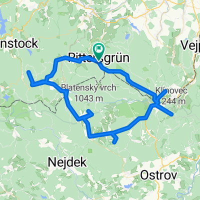
Overview
About this route
erst anstrengen, dann in einer tschechischen Käserei essen gehen (sehr zu empfehlen) danach bequem nach hause radeln
- -:--
- Duration
- 25.7 km
- Distance
- 409 m
- Ascent
- 409 m
- Descent
- ---
- Avg. speed
- ---
- Max. altitude

Continue with Bikemap
Use, edit, or download this cycling route
You would like to ride Käserei CZ or customize it for your own trip? Here is what you can do with this Bikemap route:
Free features
- Save this route as favorite or in collections
- Copy & plan your own version of this route
- Sync your route with Garmin or Wahoo
Premium features
Free trial for 3 days, or one-time payment. More about Bikemap Premium.
- Navigate this route on iOS & Android
- Export a GPX / KML file of this route
- Create your custom printout (try it for free)
- Download this route for offline navigation
Discover more Premium features.
Get Bikemap PremiumFrom our community
Other popular routes starting in Rittersgrün
 R - Schlettau - Preßnitztal - Jöhstadt - Medenec - Bozi Dar - R
- Distance
- 108.6 km
- Ascent
- 1,081 m
- Descent
- 1,081 m
- Location
- Rittersgrün, Saxony, Germany
 Zollstraße 4, Breitenbrunn/Erzgebirge nach Zollstraße 4, Breitenbrunn/Erzgebirge
- Distance
- 23.5 km
- Ascent
- 155 m
- Descent
- 155 m
- Location
- Rittersgrün, Saxony, Germany
 Breitenbrunn - Sosa Talsperre - Breitenbrunn
- Distance
- 24.4 km
- Ascent
- 708 m
- Descent
- 708 m
- Location
- Rittersgrün, Saxony, Germany
 Fünf 1000er Erzgebirge
- Distance
- 82.7 km
- Ascent
- 1,521 m
- Descent
- 1,521 m
- Location
- Rittersgrün, Saxony, Germany
 Rittersgrün-Oberwiesenthal-Markersbach-Runde
- Distance
- 52.5 km
- Ascent
- 1,090 m
- Descent
- 1,111 m
- Location
- Rittersgrün, Saxony, Germany
 SMQ MTB C-Edition Umleitung Drückjagd Rittersgrün-Fichtelberg 09.10.2021
- Distance
- 16 km
- Ascent
- 689 m
- Descent
- 135 m
- Location
- Rittersgrün, Saxony, Germany
 Käserei CZ
- Distance
- 25.7 km
- Ascent
- 409 m
- Descent
- 409 m
- Location
- Rittersgrün, Saxony, Germany
 Roter Fuchs
- Distance
- 13.4 km
- Ascent
- 394 m
- Descent
- 397 m
- Location
- Rittersgrün, Saxony, Germany
Open it in the app