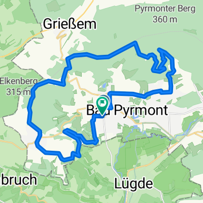
Skinfit Tour 1 (Um die Hochebene)
A cycling route starting in Bad Pyrmont, Lower Saxony, Germany.
Overview
About this route
Flache Strecke geeignet für ruhige Ausfahrten. Oder auch für Tempo-Training in der Ebene.
Skinfit Partner Gunther Swoboda Drake Str.1 31812 Bad Pyrmont Fon +49(0)170 2027725 Fon +49(0)5281 160 51 33 Fax +49(0)5281 160 51 34 gunther.swoboda@skinfit.eu
- -:--
- Duration
- 68.7 km
- Distance
- 388 m
- Ascent
- 398 m
- Descent
- ---
- Avg. speed
- 221 m
- Avg. speed
Route quality
Waytypes & surfaces along the route
Waytypes
Busy road
19.6 km
(29 %)
Quiet road
16.1 km
(23 %)
Surfaces
Paved
49.7 km
(72 %)
Unpaved
2.2 km
(3 %)
Asphalt
40.9 km
(60 %)
Paving stones
4.8 km
(7 %)
Continue with Bikemap
Use, edit, or download this cycling route
You would like to ride Skinfit Tour 1 (Um die Hochebene) or customize it for your own trip? Here is what you can do with this Bikemap route:
Free features
- Save this route as favorite or in collections
- Copy & plan your own version of this route
- Sync your route with Garmin or Wahoo
Premium features
Free trial for 3 days, or one-time payment. More about Bikemap Premium.
- Navigate this route on iOS & Android
- Export a GPX / KML file of this route
- Create your custom printout (try it for free)
- Download this route for offline navigation
Discover more Premium features.
Get Bikemap PremiumFrom our community
Other popular routes starting in Bad Pyrmont
- Bad Pyrmont-Rühler-Schweiz
- Distance
- 106.7 km
- Ascent
- 1,293 m
- Descent
- 1,239 m
- Location
- Bad Pyrmont, Lower Saxony, Germany
- Langer Grund-Schellenturm-Hagen -Holzhausen August 2013
- Distance
- 26.7 km
- Ascent
- 441 m
- Descent
- 437 m
- Location
- Bad Pyrmont, Lower Saxony, Germany
- MTB - Bad Pyrmont Hohe Stolle- Grenzweg-Schlangenweg
- Distance
- 15.5 km
- Ascent
- 353 m
- Descent
- 342 m
- Location
- Bad Pyrmont, Lower Saxony, Germany
- Halbe Runde um Bad Pyrmont
- Distance
- 30.8 km
- Ascent
- 444 m
- Descent
- 443 m
- Location
- Bad Pyrmont, Lower Saxony, Germany
- Runde um Bad Pyrmont
- Distance
- 31.5 km
- Ascent
- 489 m
- Descent
- 485 m
- Location
- Bad Pyrmont, Lower Saxony, Germany
- Bad Pyrmont-Ostwestfalenstraße-Köterberg
- Distance
- 86.1 km
- Ascent
- 757 m
- Descent
- 757 m
- Location
- Bad Pyrmont, Lower Saxony, Germany
- Bad Pyrmont nach Burgdorf (Schneverdingen)
- Distance
- 160.1 km
- Ascent
- 762 m
- Descent
- 821 m
- Location
- Bad Pyrmont, Lower Saxony, Germany
- Bad Pyrmont - Hannover
- Distance
- 91.8 km
- Ascent
- 600 m
- Descent
- 652 m
- Location
- Bad Pyrmont, Lower Saxony, Germany
Open it in the app