

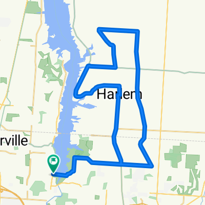
Westerville 23 Mile Marked Route
A cycling route starting in Huber Ridge, Ohio, United States of America.
Overview
About this route
A 23 mile marked route through Westerville, OH.
- -:--
- Duration
- 37.4 km
- Distance
- 134 m
- Ascent
- 134 m
- Descent
- ---
- Avg. speed
- ---
- Max. altitude
Route quality
Waytypes & surfaces along the route
Waytypes
Road
26.3 km
(70 %)
Quiet road
4.6 km
(12 %)
Surfaces
Paved
17.6 km
(47 %)
Asphalt
17.6 km
(47 %)
Undefined
19.8 km
(53 %)
Continue with Bikemap
Use, edit, or download this cycling route
You would like to ride Westerville 23 Mile Marked Route or customize it for your own trip? Here is what you can do with this Bikemap route:
Free features
- Save this route as favorite or in collections
- Copy & plan your own version of this route
- Sync your route with Garmin or Wahoo
Premium features
Free trial for 3 days, or one-time payment. More about Bikemap Premium.
- Navigate this route on iOS & Android
- Export a GPX / KML file of this route
- Create your custom printout (try it for free)
- Download this route for offline navigation
Discover more Premium features.
Get Bikemap PremiumFrom our community
Other popular routes starting in Huber Ridge
 Westerville Ohio 16 Miles
- Distance
- 26.3 km
- Ascent
- 89 m
- Descent
- 89 m
- Location
- Huber Ridge, Ohio, United States of America
 Hoover
- Distance
- 38.9 km
- Ascent
- 141 m
- Descent
- 129 m
- Location
- Huber Ridge, Ohio, United States of America
 Modified WCC
- Distance
- 31.8 km
- Ascent
- 96 m
- Descent
- 95 m
- Location
- Huber Ridge, Ohio, United States of America
 Westerville 23 Mile Marked Route
- Distance
- 37.4 km
- Ascent
- 134 m
- Descent
- 134 m
- Location
- Huber Ridge, Ohio, United States of America
 home to church
- Distance
- 11 km
- Ascent
- 82 m
- Descent
- 35 m
- Location
- Huber Ridge, Ohio, United States of America
 S Hempstead Rd, Westerville to N State St, Westerville
- Distance
- 6.1 km
- Ascent
- 18 m
- Descent
- 18 m
- Location
- Huber Ridge, Ohio, United States of America
 Granville Ride
- Distance
- 50.8 km
- Ascent
- 277 m
- Descent
- 226 m
- Location
- Huber Ridge, Ohio, United States of America
 426–432 S Sunbury Rd, Westerville to 434–458 S Sunbury Rd, Westerville
- Distance
- 6 km
- Ascent
- 73 m
- Descent
- 73 m
- Location
- Huber Ridge, Ohio, United States of America
Open it in the app