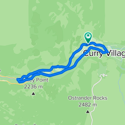
Glacier point
A cycling route starting in Yosemite Valley, California, United States of America.
Overview
About this route
- -:--
- Duration
- 52.7 km
- Distance
- 1,469 m
- Ascent
- 447 m
- Descent
- ---
- Avg. speed
- ---
- Avg. speed
Route quality
Waytypes & surfaces along the route
Waytypes
Busy road
24.5 km
(46 %)
Road
21.6 km
(41 %)
Surfaces
Paved
49.8 km
(94 %)
Unpaved
0.3 km
(<1 %)
Asphalt
49.8 km
(94 %)
Unpaved (undefined)
0.2 km
(<1 %)
Continue with Bikemap
Use, edit, or download this cycling route
You would like to ride Glacier point or customize it for your own trip? Here is what you can do with this Bikemap route:
Free features
- Save this route as favorite or in collections
- Copy & plan your own version of this route
- Sync your route with Garmin or Wahoo
Premium features
Free trial for 3 days, or one-time payment. More about Bikemap Premium.
- Navigate this route on iOS & Android
- Export a GPX / KML file of this route
- Create your custom printout (try it for free)
- Download this route for offline navigation
Discover more Premium features.
Get Bikemap PremiumFrom our community
Other popular routes starting in Yosemite Valley
- Yosemite Falls
- Distance
- 5.5 km
- Ascent
- 1,484 m
- Descent
- 687 m
- Location
- Yosemite Valley, California, United States of America
- Yosemite lodge-Curry village-Yosemite village loop
- Distance
- 14.2 km
- Ascent
- 185 m
- Descent
- 183 m
- Location
- Yosemite Valley, California, United States of America
- Yosemite Valley Loop
- Distance
- 20.4 km
- Ascent
- 241 m
- Descent
- 239 m
- Location
- Yosemite Valley, California, United States of America
- Cascade Picnic to Stoneman Valley Loop
- Distance
- 30.5 km
- Ascent
- 287 m
- Descent
- 294 m
- Location
- Yosemite Valley, California, United States of America
- Glacier point
- Distance
- 52.7 km
- Ascent
- 1,469 m
- Descent
- 447 m
- Location
- Yosemite Valley, California, United States of America
- Taioga Road: Crane Flat to Olmstead Point
- Distance
- 94.7 km
- Ascent
- 1,523 m
- Descent
- 1,523 m
- Location
- Yosemite Valley, California, United States of America
- Yos Ride
- Distance
- 49 km
- Ascent
- 856 m
- Descent
- 917 m
- Location
- Yosemite Valley, California, United States of America
- Yosemite Nat.Park to Santa Rosa
- Distance
- 406.1 km
- Ascent
- 1,642 m
- Descent
- 2,813 m
- Location
- Yosemite Valley, California, United States of America