

EC2009 Etappe 6
A cycling route starting in Vrchlabí, Královéhradecký kraj, Czechia.
Overview
About this route
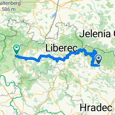
Vrchlabi (Czech Republic) - Zandov (Czech Republic)
- -:--
- Duration
- 167.4 km
- Distance
- 2,993 m
- Ascent
- 3,182 m
- Descent
- ---
- Avg. speed
- 1,401 m
- Max. altitude
Route quality
Waytypes & surfaces along the route
Waytypes
Quiet road
20.1 km
(12 %)
Track
13.4 km
(8 %)
Surfaces
Paved
100.4 km
(60 %)
Unpaved
8.4 km
(5 %)
Asphalt
100.4 km
(60 %)
Unpaved (undefined)
5 km
(3 %)
Route highlights
Points of interest along the route

Point of interest after 30.4 km
Kesselkoppe 1435m
Continue with Bikemap
Use, edit, or download this cycling route
You would like to ride EC2009 Etappe 6 or customize it for your own trip? Here is what you can do with this Bikemap route:
Free features
- Save this route as favorite or in collections
- Copy & plan your own version of this route
- Split it into stages to create a multi-day tour
- Sync your route with Garmin or Wahoo
Premium features
Free trial for 3 days, or one-time payment. More about Bikemap Premium.
- Navigate this route on iOS & Android
- Export a GPX / KML file of this route
- Create your custom printout (try it for free)
- Download this route for offline navigation
Discover more Premium features.
Get Bikemap PremiumFrom our community
Other popular routes starting in Vrchlabí
 Bikearena_Komenskeho
- Distance
- 59.6 km
- Ascent
- 914 m
- Descent
- 913 m
- Location
- Vrchlabí, Královéhradecký kraj, Czechia
 Dolní Branná to Dolní Branná
- Distance
- 3.5 km
- Ascent
- 0 m
- Descent
- 0 m
- Location
- Vrchlabí, Královéhradecký kraj, Czechia
 Strážné okruh
- Distance
- 15.3 km
- Ascent
- 353 m
- Descent
- 352 m
- Location
- Vrchlabí, Královéhradecký kraj, Czechia
 EC2009 Etappe 6
- Distance
- 167.4 km
- Ascent
- 2,993 m
- Descent
- 3,182 m
- Location
- Vrchlabí, Královéhradecký kraj, Czechia
 Krkonošská 153, Vrchlabí nach Lidická 3, Jablonec nad Nisou
- Distance
- 63.6 km
- Ascent
- 1,584 m
- Descent
- 1,594 m
- Location
- Vrchlabí, Královéhradecký kraj, Czechia
 Vrchlabi Benecko Ponikla Misecky Zlatak Spindlerovka
- Distance
- 105.4 km
- Ascent
- 2,332 m
- Descent
- 2,334 m
- Location
- Vrchlabí, Královéhradecký kraj, Czechia
 ITF3 - 160km
- Distance
- 159 km
- Ascent
- 1,996 m
- Descent
- 2,065 m
- Location
- Vrchlabí, Královéhradecký kraj, Czechia
 ITF3 - 109km
- Distance
- 108.9 km
- Ascent
- 1,163 m
- Descent
- 1,232 m
- Location
- Vrchlabí, Královéhradecký kraj, Czechia
Open it in the app