

Schulhof 6, Sigmaringen to Karl-Anton-Platz 8, Sigmaringen
A cycling route starting in Sigmaringen, Baden-Wurttemberg, Germany.
Overview
About this route
- 18 min
- Duration
- 0.8 km
- Distance
- 10 m
- Ascent
- 18 m
- Descent
- 2.9 km/h
- Avg. speed
- 589 m
- Max. altitude

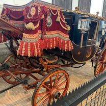
Route photos


Route quality
Waytypes & surfaces along the route
Waytypes
Pedestrian area
0.3 km
(39 %)
Road
0.2 km
(21 %)
Surfaces
Paved
0.5 km
(59 %)
Asphalt
0.4 km
(46 %)
Paved (undefined)
0.1 km
(13 %)
Undefined
0.3 km
(41 %)
Continue with Bikemap
Use, edit, or download this cycling route
You would like to ride Schulhof 6, Sigmaringen to Karl-Anton-Platz 8, Sigmaringen or customize it for your own trip? Here is what you can do with this Bikemap route:
Free features
- Save this route as favorite or in collections
- Copy & plan your own version of this route
- Sync your route with Garmin or Wahoo
Premium features
Free trial for 3 days, or one-time payment. More about Bikemap Premium.
- Navigate this route on iOS & Android
- Export a GPX / KML file of this route
- Create your custom printout (try it for free)
- Download this route for offline navigation
Discover more Premium features.
Get Bikemap PremiumFrom our community
Other popular routes starting in Sigmaringen
 Tag 2 Sigmaringen nach Riedheim
- Distance
- 138 km
- Ascent
- 1,026 m
- Descent
- 1,150 m
- Location
- Sigmaringen, Baden-Wurttemberg, Germany
 Sigmaringen
- Distance
- 114.2 km
- Ascent
- 747 m
- Descent
- 757 m
- Location
- Sigmaringen, Baden-Wurttemberg, Germany
 Donauradweg Siegmaringen - Riedlingen
- Distance
- 35.3 km
- Ascent
- 148 m
- Descent
- 203 m
- Location
- Sigmaringen, Baden-Wurttemberg, Germany
 UDB03_Sigmaringen-Tuttlingen
- Distance
- 57.6 km
- Ascent
- 312 m
- Descent
- 261 m
- Location
- Sigmaringen, Baden-Wurttemberg, Germany
 Donauradweg DE 3
- Distance
- 82.6 km
- Ascent
- 277 m
- Descent
- 369 m
- Location
- Sigmaringen, Baden-Wurttemberg, Germany
 Schulhof 6, Sigmaringen to Karl-Anton-Platz 8, Sigmaringen
- Distance
- 0.8 km
- Ascent
- 10 m
- Descent
- 18 m
- Location
- Sigmaringen, Baden-Wurttemberg, Germany
 Tour 1 - Schmeiental-Tour
- Distance
- 21.6 km
- Ascent
- 375 m
- Descent
- 375 m
- Location
- Sigmaringen, Baden-Wurttemberg, Germany
 19. Sigmaringen-Riedsee/Donaueschingen (izvor Dunava)
- Distance
- 86.6 km
- Ascent
- 1,358 m
- Descent
- 1,256 m
- Location
- Sigmaringen, Baden-Wurttemberg, Germany
Open it in the app