

Giro della Marzola - Giro della Marzola
A cycling route starting in Vigolo Vattaro, Trentino-Alto Adige, Italy.
Overview
About this route
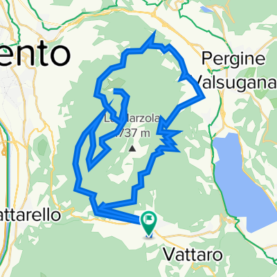
A mountain bike ride dedicated to discovering the Marzola with spectacular views of the Adige valley and Monte Bondone, on the northern slope of the Vigolana, the Valsugana and the Mocheni Valley. - A mountain bike ride dedicated to discovering the Marzola with spectacular views of the Adige valley and Monte Bondone, on the northern slope of the Vigolana, the Valsugana and the Mocheni Valley. Type: Undefined Distance: 30.7 km (00:00) Minimum altitude: 449 m Maximum altitude: 1200 m Positive elevation gain: 1278 m Negative elevation loss: 1278 m
- -:--
- Duration
- 40.6 km
- Distance
- 1,953 m
- Ascent
- 1,953 m
- Descent
- ---
- Avg. speed
- 1,343 m
- Max. altitude
Continue with Bikemap
Use, edit, or download this cycling route
You would like to ride Giro della Marzola - Giro della Marzola or customize it for your own trip? Here is what you can do with this Bikemap route:
Free features
- Save this route as favorite or in collections
- Copy & plan your own version of this route
- Sync your route with Garmin or Wahoo
Premium features
Free trial for 3 days, or one-time payment. More about Bikemap Premium.
- Navigate this route on iOS & Android
- Export a GPX / KML file of this route
- Create your custom printout (try it for free)
- Download this route for offline navigation
Discover more Premium features.
Get Bikemap PremiumFrom our community
Other popular routes starting in Vigolo Vattaro
 Forti di Lavarone
- Distance
- 80.5 km
- Ascent
- 1,564 m
- Descent
- 1,564 m
- Location
- Vigolo Vattaro, Trentino-Alto Adige, Italy
 e-bike
- Distance
- 98.6 km
- Ascent
- 2,534 m
- Descent
- 2,534 m
- Location
- Vigolo Vattaro, Trentino-Alto Adige, Italy
 giro castello di vigolo vattaro.
- Distance
- 11.9 km
- Ascent
- 1,086 m
- Descent
- 254 m
- Location
- Vigolo Vattaro, Trentino-Alto Adige, Italy
 Marzola
- Distance
- 7.7 km
- Ascent
- 884 m
- Descent
- 889 m
- Location
- Vigolo Vattaro, Trentino-Alto Adige, Italy
 Test mtb
- Distance
- 10.3 km
- Ascent
- 341 m
- Descent
- 528 m
- Location
- Vigolo Vattaro, Trentino-Alto Adige, Italy
 Vigolo, Santa Caterina, Valcanover, Caldonazzo, Campregheri, Vigolo
- Distance
- 23.9 km
- Ascent
- 1,039 m
- Descent
- 1,037 m
- Location
- Vigolo Vattaro, Trentino-Alto Adige, Italy
 Giro della Marzola - Giro della Marzola
- Distance
- 40.6 km
- Ascent
- 1,953 m
- Descent
- 1,953 m
- Location
- Vigolo Vattaro, Trentino-Alto Adige, Italy
 idro3
idro3- Distance
- 141 km
- Ascent
- 3,858 m
- Descent
- 4,365 m
- Location
- Vigolo Vattaro, Trentino-Alto Adige, Italy
Open it in the app