Etappe 3 La Brevine - St. Ursanne, via Moreau-Val du Dessoubre -Hippolythe- St. Ursanne
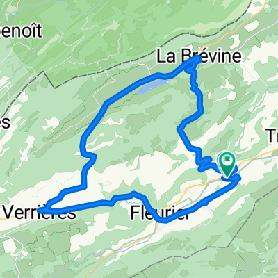
A cycling route starting in Couvet, Canton of Neuchâtel, Switzerland.
Overview
About this route
von La Brevine gings bald hinüber nach F Morteau und dann über Les Fins - Fuans nach Gigot zum z Mittag, dann weiter gemäss titel nach St. Ursanne, von dort per Zug heim
- -:--
- Duration
- 108.3 km
- Distance
- 519 m
- Ascent
- 1,102 m
- Descent
- ---
- Avg. speed
- ---
- Max. altitude
Route quality
Waytypes & surfaces along the route
Waytypes
Busy road
89 km
(82 %)
Road
9.3 km
(9 %)
Surfaces
Paved
41.1 km
(38 %)
Unpaved
2.8 km
(3 %)
Asphalt
30.2 km
(28 %)
Paved (undefined)
10.9 km
(10 %)
Continue with Bikemap
Use, edit, or download this cycling route
You would like to ride Etappe 3 La Brevine - St. Ursanne, via Moreau-Val du Dessoubre -Hippolythe- St. Ursanne or customize it for your own trip? Here is what you can do with this Bikemap route:
Free features
- Save this route as favorite or in collections
- Copy & plan your own version of this route
- Split it into stages to create a multi-day tour
- Sync your route with Garmin or Wahoo
Premium features
Free trial for 3 days, or one-time payment. More about Bikemap Premium.
- Navigate this route on iOS & Android
- Export a GPX / KML file of this route
- Create your custom printout (try it for free)
- Download this route for offline navigation
Discover more Premium features.
Get Bikemap PremiumFrom our community
Other popular routes starting in Couvet
- Etappe 3 La Brevine - St. Ursanne, via Moreau-Val du Dessoubre -Hippolythe- St. Ursanne
- Distance
- 108.3 km
- Ascent
- 519 m
- Descent
- 1,102 m
- Location
- Couvet, Canton of Neuchâtel, Switzerland
- Val de Travers / Tailleres round trip
- Distance
- 47.6 km
- Ascent
- 591 m
- Descent
- 588 m
- Location
- Couvet, Canton of Neuchâtel, Switzerland
- Couvet - Neuchatel (over the top)
- Distance
- 44.8 km
- Ascent
- 628 m
- Descent
- 936 m
- Location
- Couvet, Canton of Neuchâtel, Switzerland
- Jura Tour: Couvet -> Saignlegier
- Distance
- 70.4 km
- Ascent
- 885 m
- Descent
- 639 m
- Location
- Couvet, Canton of Neuchâtel, Switzerland
- Les Taillères, Montlebon, Nid du Fol, Rundfahrt
- Distance
- 39.7 km
- Ascent
- 681 m
- Descent
- 679 m
- Location
- Couvet, Canton of Neuchâtel, Switzerland
- Val de Travers / Vallon de Noirvaux
- Distance
- 38.4 km
- Ascent
- 431 m
- Descent
- 429 m
- Location
- Couvet, Canton of Neuchâtel, Switzerland
- 8. Etappe_Tour de Suisse
- Distance
- 108.3 km
- Ascent
- 1,350 m
- Descent
- 1,715 m
- Location
- Couvet, Canton of Neuchâtel, Switzerland
- Jura Tour: Couvet - Bellelay
- Distance
- 80.2 km
- Ascent
- 1,012 m
- Descent
- 792 m
- Location
- Couvet, Canton of Neuchâtel, Switzerland
Open it in the app