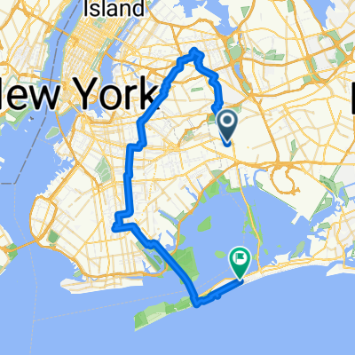
Forest Hills to Fort Tilden
A cycling route starting in Borough of Queens, New York, United States of America.
Overview
About this route
Ride to Fort Tilden via the Brooklyn Parkway bike service lane
The first part, along Woodhave Blvd is miserable. Riding alongside the cars on that road is the least enjoyable part of the ride. As much as I've tried to find an alternative path, it doesn't seem that one exists.
Also, the middle portion of the ride -- the one that appears to be on the highway -- is actually alongside the bike path that runs along the eastbound portion of the highway. From there, a turn toward toward Fort Tilden is possible.
- -:--
- Duration
- 27.6 km
- Distance
- 70 m
- Ascent
- 92 m
- Descent
- ---
- Avg. speed
- ---
- Avg. speed
Continue with Bikemap
Use, edit, or download this cycling route
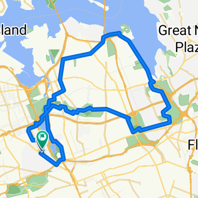
You would like to ride Forest Hills to Fort Tilden or customize it for your own trip? Here is what you can do with this Bikemap route:
Free features
- Save this route as favorite or in collections
- Copy & plan your own version of this route
- Sync your route with Garmin or Wahoo
Premium features
Free trial for 3 days, or one-time payment. More about Bikemap Premium.
- Navigate this route on iOS & Android
- Export a GPX / KML file of this route
- Create your custom printout (try it for free)
- Download this route for offline navigation
Discover more Premium features.
Get Bikemap PremiumFrom our community
Other popular routes starting in Borough of Queens
- Rheingold / Bushwick Loop
- Distance
- 17.7 km
- Ascent
- 60 m
- Descent
- 63 m
- Location
- Borough of Queens, New York, United States of America
- City Hall from Rego Park
- Distance
- 13.8 km
- Ascent
- 104 m
- Descent
- 103 m
- Location
- Borough of Queens, New York, United States of America
- 59th St Bridge from Rego Park #2
- Distance
- 11.1 km
- Ascent
- 55 m
- Descent
- 60 m
- Location
- Borough of Queens, New York, United States of America
- ride through New York
- Distance
- 20.9 km
- Ascent
- 185 m
- Descent
- 172 m
- Location
- Borough of Queens, New York, United States of America
- Queens Bike Bridge Explorer
- Distance
- 17.6 km
- Ascent
- 95 m
- Descent
- 95 m
- Location
- Borough of Queens, New York, United States of America
- Fresh Pond Quick Loop
- Distance
- 10.8 km
- Ascent
- 31 m
- Descent
- 38 m
- Location
- Borough of Queens, New York, United States of America
- 115th Street 149-46 to Shore Front Parkway 9111
- Distance
- 11.9 km
- Ascent
- 56 m
- Descent
- 58 m
- Location
- Borough of Queens, New York, United States of America
- Prospect Park from Rego Park #3
- Distance
- 14.1 km
- Ascent
- 103 m
- Descent
- 82 m
- Location
- Borough of Queens, New York, United States of America
Open it in the app