

23/02/23 - 09/03/23
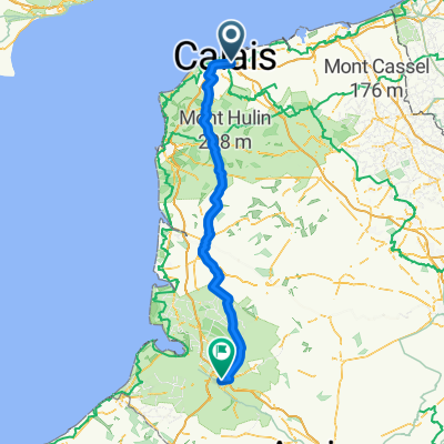
A cycling route starting in Calais, Hauts-de-France, France.
Overview
About this route
- -:--
- Duration
- 1,018.6 km
- Distance
- 1,239 m
- Ascent
- 1,214 m
- Descent
- ---
- Avg. speed
- 119 m
- Max. altitude
Route quality
Waytypes & surfaces along the route
Waytypes
Cycleway
315.8 km
(31 %)
Quiet road
264.8 km
(26 %)
Surfaces
Paved
733.4 km
(72 %)
Unpaved
10.2 km
(1 %)
Asphalt
641.7 km
(63 %)
Concrete
71.3 km
(7 %)
Route highlights
Points of interest along the route
Point of interest after 77 km
Point of interest after 219.1 km
Point of interest after 238.2 km
Point of interest after 281.8 km
Point of interest after 355 km
Point of interest after 392.1 km
Point of interest after 427.7 km
Point of interest after 444.9 km
Point of interest after 486.3 km
Point of interest after 666.2 km
Point of interest after 839.3 km
Point of interest after 962.9 km
Point of interest after 1,018.6 km
Point of interest after 1,018.6 km
Point of interest after 1,018.6 km
Point of interest after 1,018.6 km
Point of interest after 1,018.6 km
Continue with Bikemap
Use, edit, or download this cycling route
You would like to ride 23/02/23 - 09/03/23 or customize it for your own trip? Here is what you can do with this Bikemap route:
Free features
- Save this route as favorite or in collections
- Copy & plan your own version of this route
- Split it into stages to create a multi-day tour
- Sync your route with Garmin or Wahoo
Premium features
Free trial for 3 days, or one-time payment. More about Bikemap Premium.
- Navigate this route on iOS & Android
- Export a GPX / KML file of this route
- Create your custom printout (try it for free)
- Download this route for offline navigation
Discover more Premium features.
Get Bikemap PremiumFrom our community
Other popular routes starting in Calais
 Critérium de Calais
- Distance
- 30.1 km
- Ascent
- 191 m
- Descent
- 191 m
- Location
- Calais, Hauts-de-France, France
 Grey Court 2 Paris Day 2
- Distance
- 121.9 km
- Ascent
- 582 m
- Descent
- 569 m
- Location
- Calais, Hauts-de-France, France
 Stage 2- Calais- Bruge
- Distance
- 114 km
- Ascent
- 29 m
- Descent
- 22 m
- Location
- Calais, Hauts-de-France, France
 Calais nach Veurne
- Distance
- 79.8 km
- Ascent
- 44 m
- Descent
- 44 m
- Location
- Calais, Hauts-de-France, France
 Route #3
- Distance
- 123.6 km
- Ascent
- 0 m
- Descent
- 0 m
- Location
- Calais, Hauts-de-France, France
 Etapa 029C-2 (Canterbury - Aire sur la Lys)
- Distance
- 85.3 km
- Ascent
- 283 m
- Descent
- 272 m
- Location
- Calais, Hauts-de-France, France
 Alpe d’Huez Trip
- Distance
- 1,072.3 km
- Ascent
- 7,329 m
- Descent
- 5,556 m
- Location
- Calais, Hauts-de-France, France
 Calais to Istanbul
- Distance
- 3,225.4 km
- Ascent
- 1,904 m
- Descent
- 1,850 m
- Location
- Calais, Hauts-de-France, France
Open it in the app