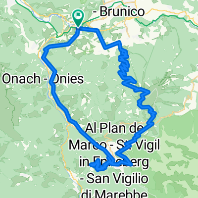
Alpencross 2011 - 3. Etappe
- 54.1 km
- 1,997 m
- 828 m
- St. Lorenzen, Trentino-Alto Adige, Italy
A cycling route starting in St. Lorenzen, Trentino-Alto Adige, Italy.
Overview
Route from Furkelpass to Kronplatz is very steep (24%) and goes on very bad road - concrete,sand,mud,gravel (better for MTB then for road - but it is possible also on road bike)
Part from Zwischenwasser to San Lorenzo is on main street and goes through many tunnels !!!!
created this 14 years ago
Route quality
Track
10.9 km
(19 %)
Quiet road
7.4 km
(13 %)
Paved
20 km
(35 %)
Unpaved
12.6 km
(22 %)
Asphalt
19.5 km
(34 %)
Gravel
6.9 km
(12 %)
Continue with Bikemap
You would like to ride Kronplatz - Furkelpass or customize it for your own trip? Here is what you can do with this Bikemap route:
Free trial for 3 days, or one-time payment. More about Bikemap Premium.
Discover more Premium features.
Get Bikemap PremiumFrom our community
Open it in the app