Bad Rohtenfelde - Burg Ravensberg
A cycling route starting in Bad Rothenfelde, Lower Saxony, Germany.
Overview
About this route
- 2 h 38 min
- Duration
- 30.5 km
- Distance
- 262 m
- Ascent
- 250 m
- Descent
- 11.6 km/h
- Avg. speed
- 204 m
- Max. altitude
Route photos
Route quality
Waytypes & surfaces along the route
Waytypes
Quiet road
14.3 km
(47 %)
Road
7.6 km
(25 %)
Surfaces
Paved
14.3 km
(47 %)
Unpaved
2.4 km
(8 %)
Asphalt
14 km
(46 %)
Gravel
1.8 km
(6 %)
Continue with Bikemap
Use, edit, or download this cycling route
You would like to ride Bad Rohtenfelde - Burg Ravensberg or customize it for your own trip? Here is what you can do with this Bikemap route:
Free features
- Save this route as favorite or in collections
- Copy & plan your own version of this route
- Sync your route with Garmin or Wahoo
Premium features
Free trial for 3 days, or one-time payment. More about Bikemap Premium.
- Navigate this route on iOS & Android
- Export a GPX / KML file of this route
- Create your custom printout (try it for free)
- Download this route for offline navigation
Discover more Premium features.
Get Bikemap PremiumFrom our community
Other popular routes starting in Bad Rothenfelde
- Rothenf.-Remsede-Laer-MüschenBockh.-Dissen-Rothenf. 40Km
- Distance
- 38.4 km
- Ascent
- 177 m
- Descent
- 178 m
- Location
- Bad Rothenfelde, Lower Saxony, Germany
- Bad Rothenfelde Westbarthausen Dissen
- Distance
- 20.6 km
- Ascent
- 92 m
- Descent
- 94 m
- Location
- Bad Rothenfelde, Lower Saxony, Germany
- Bad Rothenfelde-Bad Laer-Bad Iburg-Bad Rothenfelde
- Distance
- 39.4 km
- Ascent
- 149 m
- Descent
- 146 m
- Location
- Bad Rothenfelde, Lower Saxony, Germany
- Bad Rohtenfelde zum Luisenrurm Rundtour
- Distance
- 33.9 km
- Ascent
- 568 m
- Descent
- 565 m
- Location
- Bad Rothenfelde, Lower Saxony, Germany
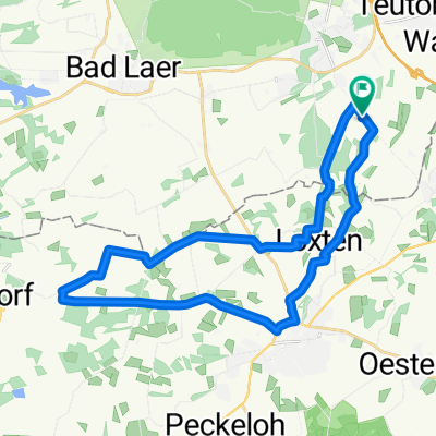
- Teutoburger-Wald-Straße 33, Bad Rothenfelde nach Teutoburger-Wald-Straße 33, Bad Rothenfelde
- Distance
- 17.7 km
- Ascent
- 278 m
- Descent
- 272 m
- Location
- Bad Rothenfelde, Lower Saxony, Germany
- Bad Rothenfelder Bäder-RTF 75km 2009
- Distance
- 71.6 km
- Ascent
- 80 m
- Descent
- 80 m
- Location
- Bad Rothenfelde, Lower Saxony, Germany
- über den Teutoburger Wald
- Distance
- 42.3 km
- Ascent
- 321 m
- Descent
- 321 m
- Location
- Bad Rothenfelde, Lower Saxony, Germany
- Bad Rohtenfelde - Bad Iburg
- Distance
- 39.5 km
- Ascent
- 650 m
- Descent
- 645 m
- Location
- Bad Rothenfelde, Lower Saxony, Germany
Open it in the app