

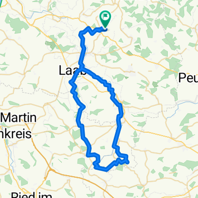
48.328° N 13.598° W nach 48.328° N 13.598° W
A cycling route starting in Sankt Marienkirchen bei Schärding, Upper Austria, Austria.
Overview
About this route
- 52 min
- Duration
- 19.2 km
- Distance
- 151 m
- Ascent
- 181 m
- Descent
- 22.1 km/h
- Avg. speed
- 411 m
- Max. altitude
Route quality
Waytypes & surfaces along the route
Waytypes
Quiet road
13.2 km
(69 %)
Road
5.4 km
(28 %)
Undefined
0.6 km
(3 %)
Surfaces
Unpaved
1.1 km
(6 %)
Unpaved (undefined)
1.1 km
(6 %)
Undefined
18 km
(94 %)
Continue with Bikemap
Use, edit, or download this cycling route
You would like to ride 48.328° N 13.598° W nach 48.328° N 13.598° W or customize it for your own trip? Here is what you can do with this Bikemap route:
Free features
- Save this route as favorite or in collections
- Copy & plan your own version of this route
- Sync your route with Garmin or Wahoo
Premium features
Free trial for 3 days, or one-time payment. More about Bikemap Premium.
- Navigate this route on iOS & Android
- Export a GPX / KML file of this route
- Create your custom printout (try it for free)
- Download this route for offline navigation
Discover more Premium features.
Get Bikemap PremiumFrom our community
Other popular routes starting in Sankt Marienkirchen bei Schärding
 Ort-Obernberg-Schärding-Teufenbach-Ort
- Distance
- 56.2 km
- Ascent
- 267 m
- Descent
- 264 m
- Location
- Sankt Marienkirchen bei Schärding, Upper Austria, Austria
 H 24, 4774 - Schardenberg - H 24
- Distance
- 47.1 km
- Ascent
- 585 m
- Descent
- 565 m
- Location
- Sankt Marienkirchen bei Schärding, Upper Austria, Austria
 Sigh._Andorf_Taiskirchen_Wimmer Stubn_Andorf_Sigh
- Distance
- 54.6 km
- Ascent
- 253 m
- Descent
- 254 m
- Location
- Sankt Marienkirchen bei Schärding, Upper Austria, Austria
 Höhentour durchs Innviertel
- Distance
- 43.1 km
- Ascent
- 317 m
- Descent
- 318 m
- Location
- Sankt Marienkirchen bei Schärding, Upper Austria, Austria
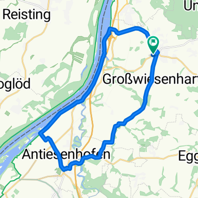
 4774 Greiner Mosthof
- Distance
- 14.6 km
- Ascent
- 156 m
- Descent
- 156 m
- Location
- Sankt Marienkirchen bei Schärding, Upper Austria, Austria
 4774 Bründlkapelle
- Distance
- 17.6 km
- Ascent
- 191 m
- Descent
- 194 m
- Location
- Sankt Marienkirchen bei Schärding, Upper Austria, Austria
 Würding Aigen am Inn
- Distance
- 41.3 km
- Ascent
- 68 m
- Descent
- 68 m
- Location
- Sankt Marienkirchen bei Schärding, Upper Austria, Austria
 Peti&Zoli
- Distance
- 22.3 km
- Ascent
- 564 m
- Descent
- 566 m
- Location
- Sankt Marienkirchen bei Schärding, Upper Austria, Austria
Open it in the app