2020 - Leine - Tag 2 - Röllinghausen - Banteln
- 15.9 km
- 56 m
- 62 m
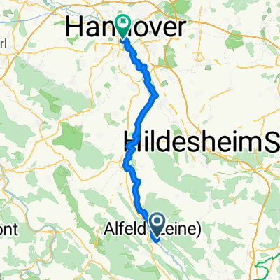
- Alfeld, Lower Saxony, Germany
A cycling route starting in Alfeld, Lower Saxony, Germany.
Overview
First stages to acclimatize and warm up.
created this 14 years ago
Route quality
Path
12.7 km
(35 %)
Track
9.4 km
(26 %)
Paved
32.7 km
(90 %)
Unpaved
0.7 km
(2 %)
Asphalt
24.7 km
(68 %)
Concrete
8 km
(22 %)
Continue with Bikemap
You would like to ride Flachlandetappe zum Eingewöhnen or customize it for your own trip? Here is what you can do with this Bikemap route:
Free trial for 3 days, or one-time payment. More about Bikemap Premium.
Discover more Premium features.
Get Bikemap PremiumFrom our community
Open it in the app