
Wasserburgen-Route - Wasserburgen-Route
A cycling route starting in Königswinter, North Rhine-Westphalia, Germany.
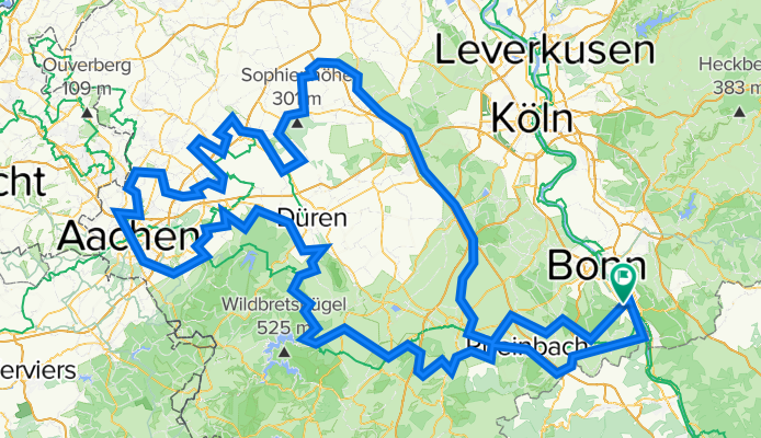
Overview
About this route
Erleben Sie eine der burgenreichsten Regionen Deutschlands und die schönen Naturlandschaften des Rheinlandes mit Wiesen, Wäldern, Flüssen, Seen und zahlreichen kulturellen Sehenswürdigkeiten die darauf warten von Ihnen entdeckt zu werden.
- -:--
- Duration
- 382.8 km
- Distance
- 2,508 m
- Ascent
- 2,508 m
- Descent
- ---
- Avg. speed
- 350 m
- Avg. speed

Route quality
Waytypes & surfaces along the route
Waytypes
Quiet road
117.9 km
(31 %)
Track
98.6 km
(26 %)
Surfaces
Paved
246.6 km
(64 %)
Unpaved
55.9 km
(15 %)
Asphalt
214.1 km
(56 %)
Gravel
36 km
(9 %)
Continue with Bikemap
Use, edit, or download this cycling route
You would like to ride Wasserburgen-Route - Wasserburgen-Route or customize it for your own trip? Here is what you can do with this Bikemap route:
Free features
- Save this route as favorite or in collections
- Copy & plan your own version of this route
- Split it into stages to create a multi-day tour
- Sync your route with Garmin or Wahoo
Premium features
Free trial for 3 days, or one-time payment. More about Bikemap Premium.
- Navigate this route on iOS & Android
- Export a GPX / KML file of this route
- Create your custom printout (try it for free)
- Download this route for offline navigation
Discover more Premium features.
Get Bikemap PremiumFrom our community
Other popular routes starting in Königswinter
 Siebengebirge Süd
- Distance
- 44 km
- Ascent
- 546 m
- Descent
- 539 m
- Location
- Königswinter, North Rhine-Westphalia, Germany
 BONN-tria 2008 mit Wechselzone
- Distance
- 58.8 km
- Ascent
- 691 m
- Descent
- 696 m
- Location
- Königswinter, North Rhine-Westphalia, Germany
 Oberkassel - Königswinter - Petersberg - Ittenbach - Stieldorf - Hangelar - Beuel
- Distance
- 39 km
- Ascent
- 525 m
- Descent
- 524 m
- Location
- Königswinter, North Rhine-Westphalia, Germany
 Thomasberg - Hennef - Pützchen
- Distance
- 40.8 km
- Ascent
- 475 m
- Descent
- 474 m
- Location
- Königswinter, North Rhine-Westphalia, Germany
 mahagonis Abschlußrunde 30.9.07 ca.60 km!
- Distance
- 50.4 km
- Ascent
- 299 m
- Descent
- 300 m
- Location
- Königswinter, North Rhine-Westphalia, Germany
 Bad Godesberg-Altenahr
- Distance
- 71.6 km
- Ascent
- 579 m
- Descent
- 589 m
- Location
- Königswinter, North Rhine-Westphalia, Germany
 MTB Tour Königswinter
- Distance
- 33.2 km
- Ascent
- 975 m
- Descent
- 975 m
- Location
- Königswinter, North Rhine-Westphalia, Germany
 Singletrailtour Siebengebirge
- Distance
- 33.4 km
- Ascent
- 1,070 m
- Descent
- 1,070 m
- Location
- Königswinter, North Rhine-Westphalia, Germany
Open it in the app