

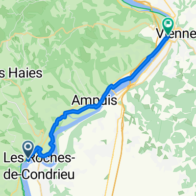
L7: Roches-de-Condrieu - Saint Clair; 66,3km 370hm
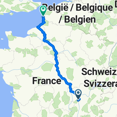
A cycling route starting in Les Roches-de-Condrieu, Auvergne-Rhône-Alpes, France.
Overview
About this route
Domaine de Saint-Clair, Lieu dit Le Pelou, Rte du Golf, 07430 Saint-Clair, France
- -:--
- Duration
- 66.3 km
- Distance
- 634 m
- Ascent
- 337 m
- Descent
- ---
- Avg. speed
- 447 m
- Max. altitude

Route quality
Waytypes & surfaces along the route
Waytypes
Cycleway
29.2 km
(44 %)
Road
17.2 km
(26 %)
Surfaces
Paved
46.4 km
(70 %)
Asphalt
46.4 km
(70 %)
Undefined
19.9 km
(30 %)
Continue with Bikemap
Use, edit, or download this cycling route
You would like to ride L7: Roches-de-Condrieu - Saint Clair; 66,3km 370hm or customize it for your own trip? Here is what you can do with this Bikemap route:
Free features
- Save this route as favorite or in collections
- Copy & plan your own version of this route
- Sync your route with Garmin or Wahoo
Premium features
Free trial for 3 days, or one-time payment. More about Bikemap Premium.
- Navigate this route on iOS & Android
- Export a GPX / KML file of this route
- Create your custom printout (try it for free)
- Download this route for offline navigation
Discover more Premium features.
Get Bikemap PremiumFrom our community
Other popular routes starting in Les Roches-de-Condrieu
 Rue de la Saulaie, Les Roches-de-Condrieu à Place Édouard VII, Le Touquet-Paris-Plage
- Distance
- 925.4 km
- Ascent
- 5,708 m
- Descent
- 5,842 m
- Location
- Les Roches-de-Condrieu, Auvergne-Rhône-Alpes, France
 66 Rue Nationale, Condrieu to 21 Quai Hippolyte Jayr, Lyon
- Distance
- 56.1 km
- Ascent
- 334 m
- Descent
- 315 m
- Location
- Les Roches-de-Condrieu, Auvergne-Rhône-Alpes, France
 L7: Roches-de-Condrieu - Saint Clair; 66,3km 370hm
- Distance
- 66.3 km
- Ascent
- 634 m
- Descent
- 337 m
- Location
- Les Roches-de-Condrieu, Auvergne-Rhône-Alpes, France
 Recovered Route
- Distance
- 14.3 km
- Ascent
- 92 m
- Descent
- 94 m
- Location
- Les Roches-de-Condrieu, Auvergne-Rhône-Alpes, France
 L8: Les-Roches-de-Condrieu - Bourg-Argental; 62,8km 690hm
- Distance
- 62.8 km
- Ascent
- 868 m
- Descent
- 474 m
- Location
- Les Roches-de-Condrieu, Auvergne-Rhône-Alpes, France
 Rue de la Maladière 5, Condrieu nach Montée du Château 11b, Tournon-sur-Rhône
- Distance
- 52.6 km
- Ascent
- 212 m
- Descent
- 224 m
- Location
- Les Roches-de-Condrieu, Auvergne-Rhône-Alpes, France
 05531-1257-Verin-Chavanay-Pelussin-ColDeLOeillon-Pavezin-Chuyer-Verin
- Distance
- 53.1 km
- Ascent
- 1,532 m
- Descent
- 1,216 m
- Location
- Les Roches-de-Condrieu, Auvergne-Rhône-Alpes, France
 5 Rue de la Décize, Les Roches-de-Condrieu to 5 Rue de la Décize, Les Roches-de-Condrieu
- Distance
- 4.2 km
- Ascent
- 290 m
- Descent
- 291 m
- Location
- Les Roches-de-Condrieu, Auvergne-Rhône-Alpes, France
Open it in the app